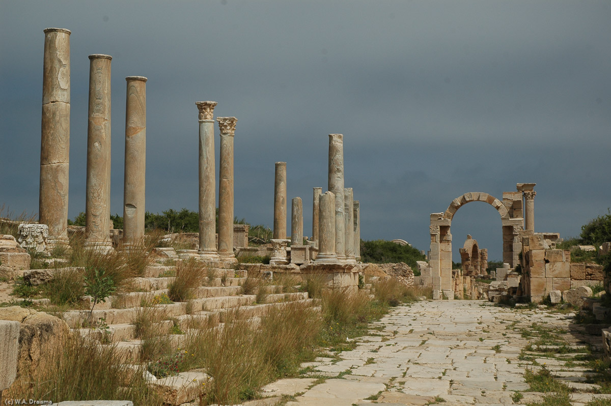
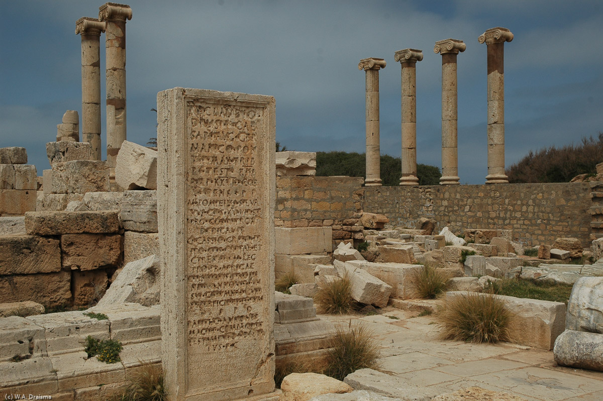
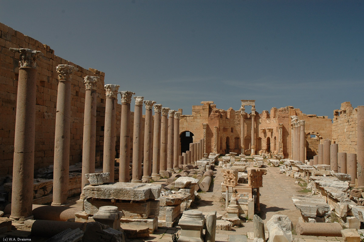
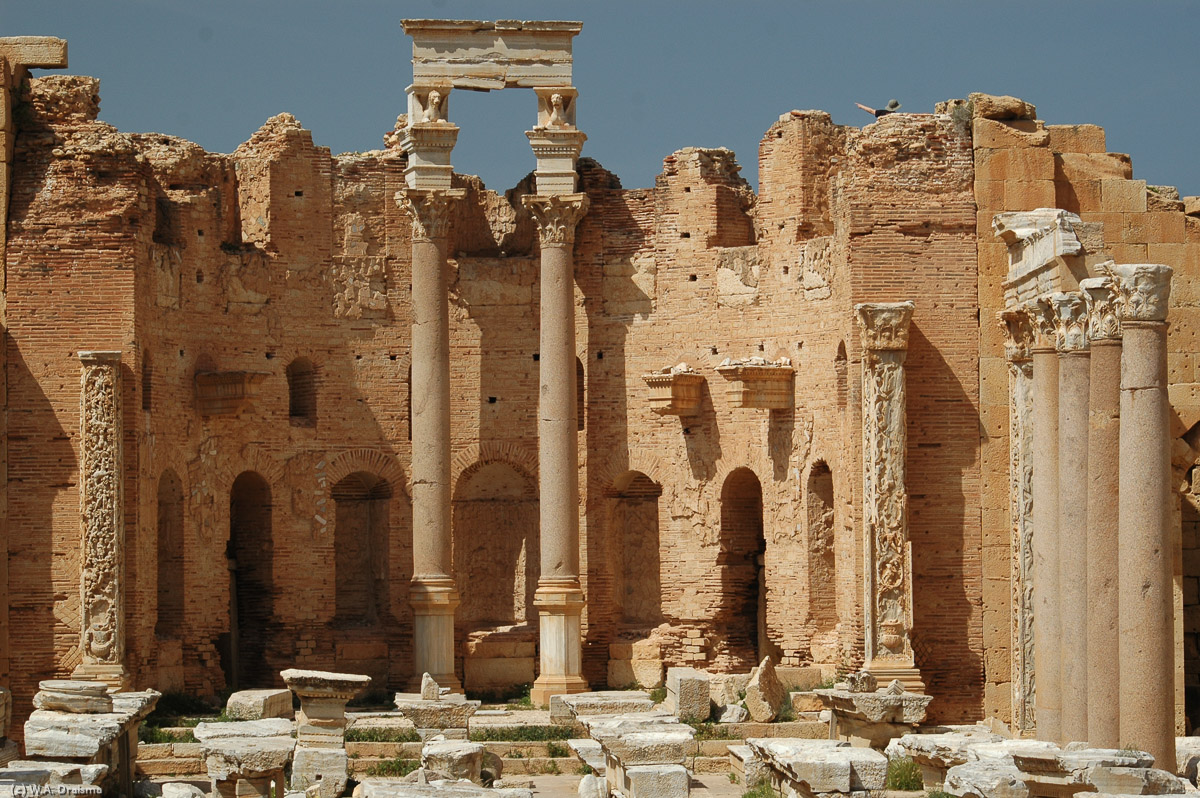
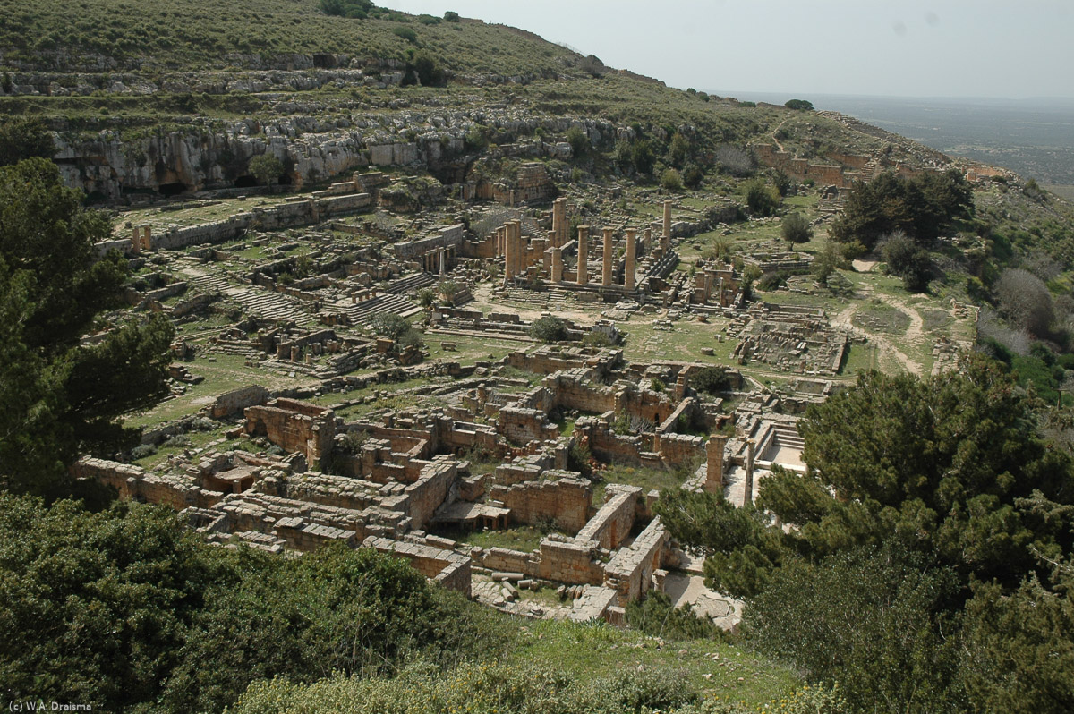
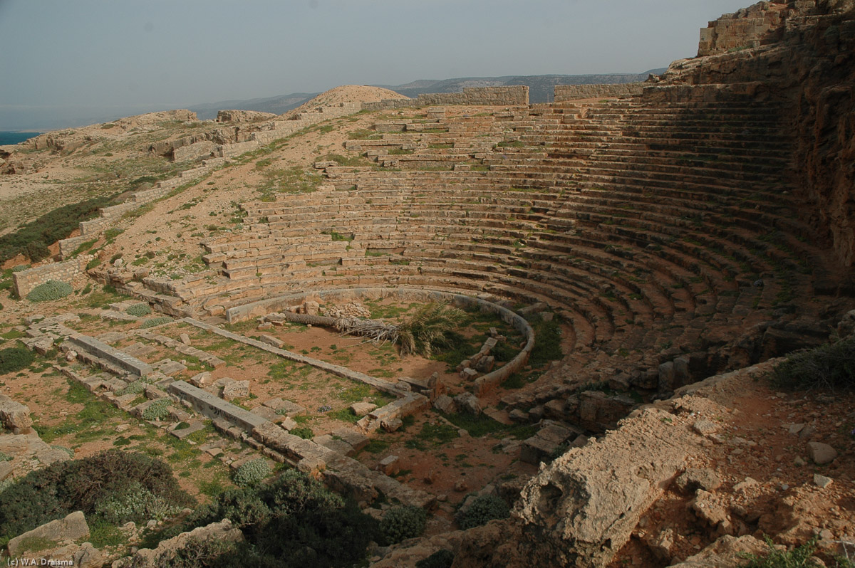
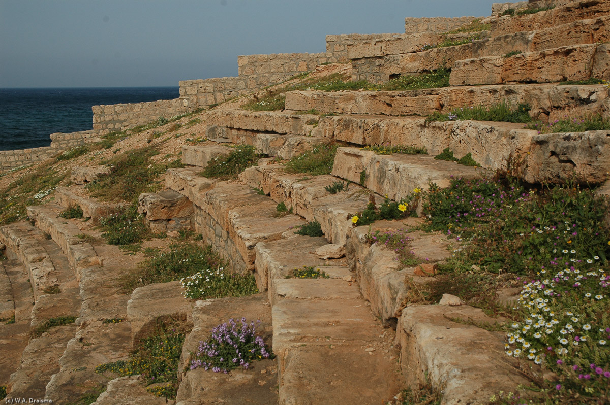
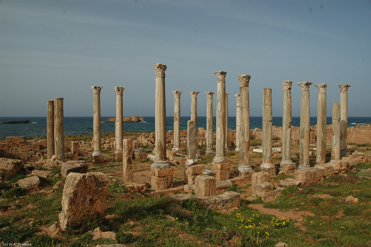
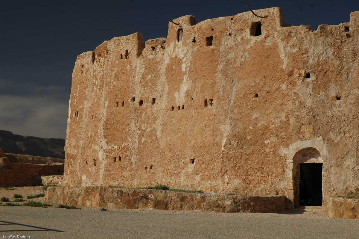
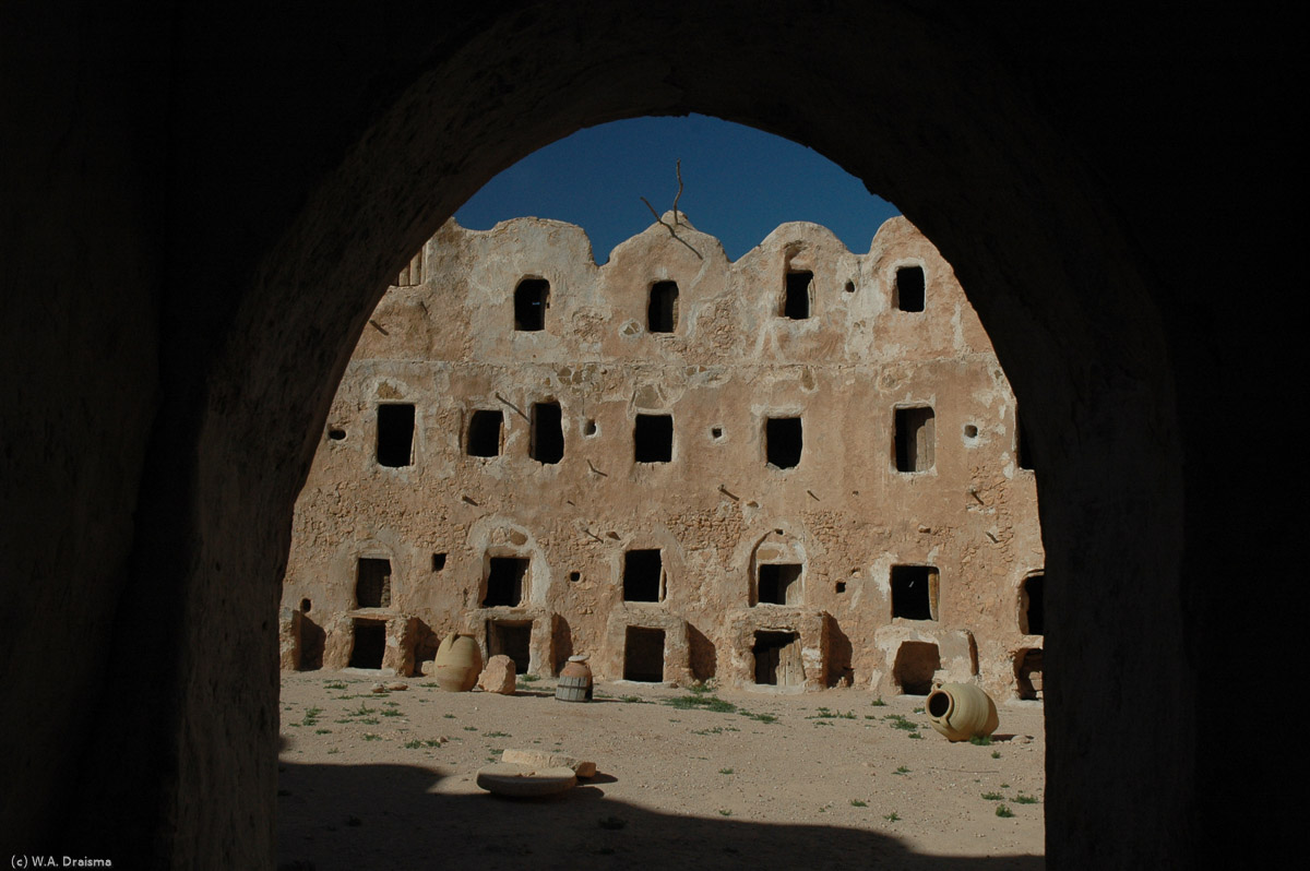
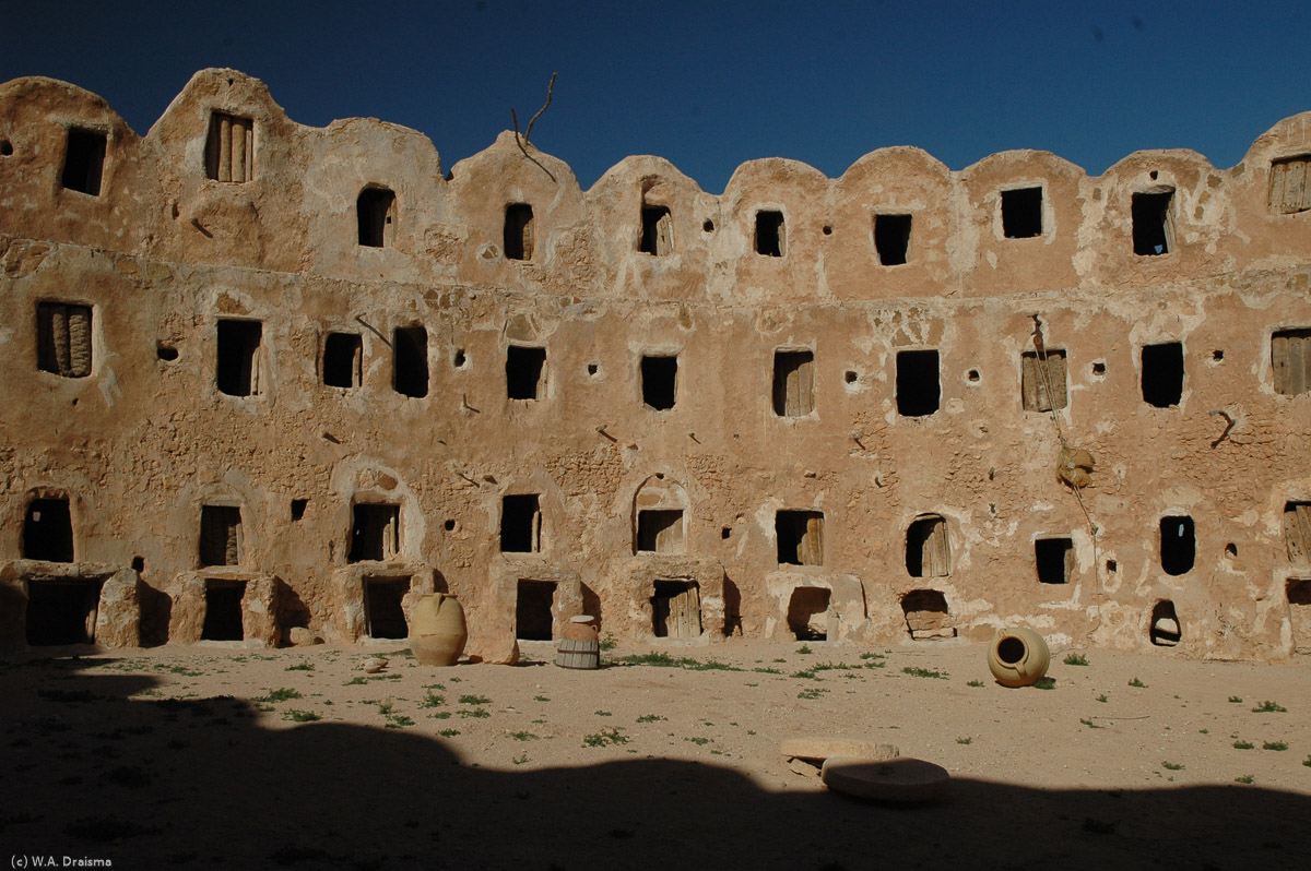
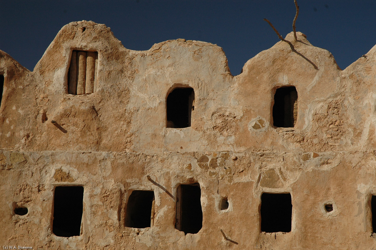
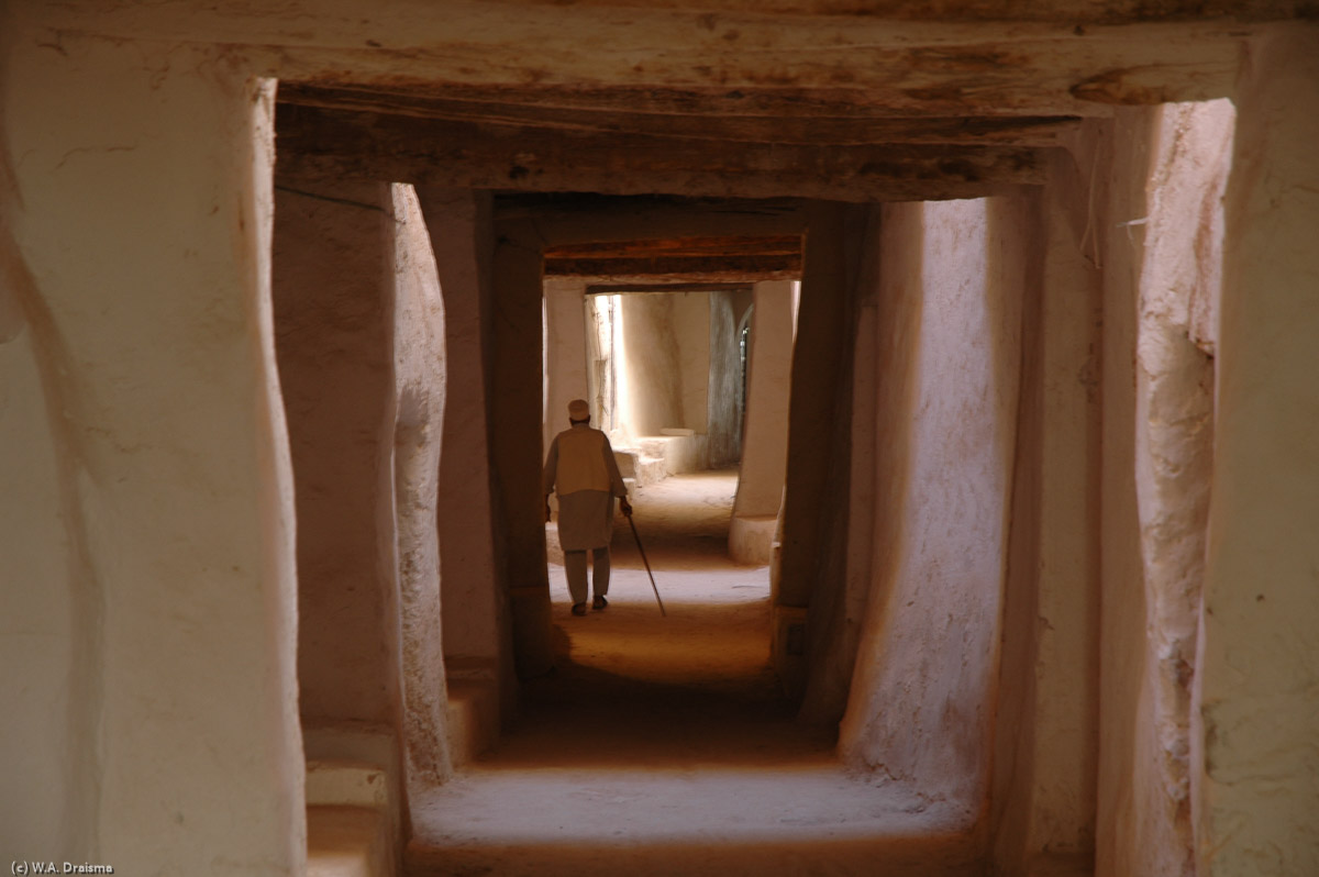
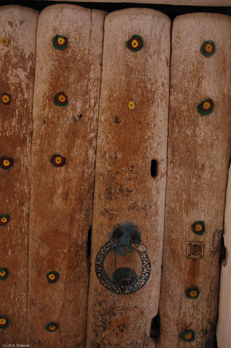
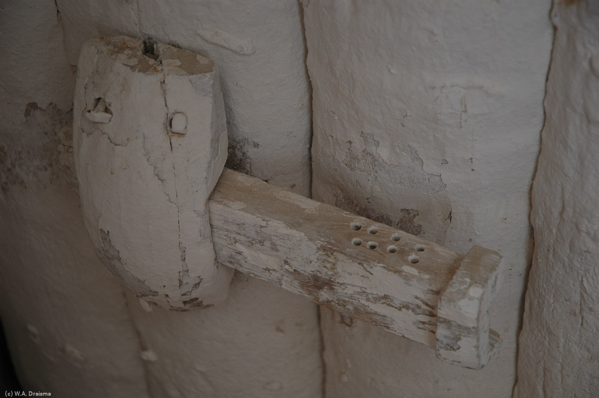
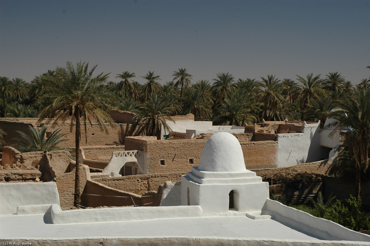
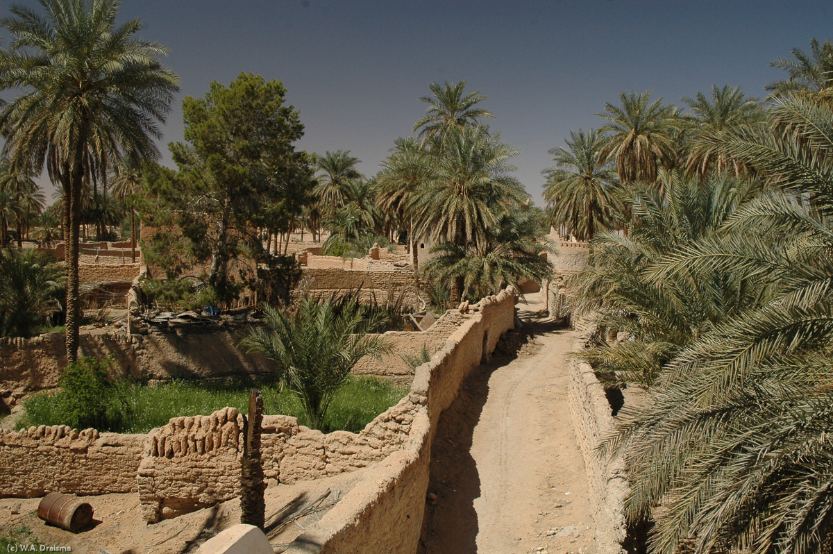
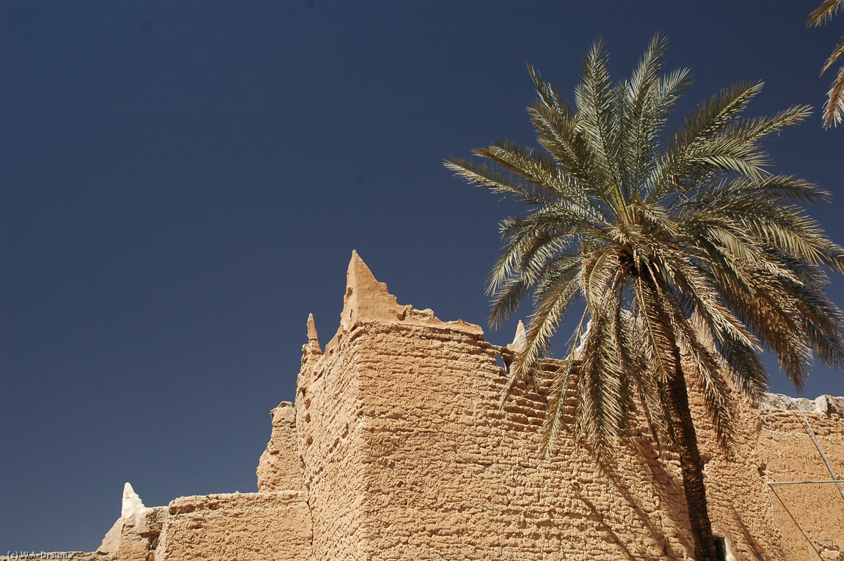
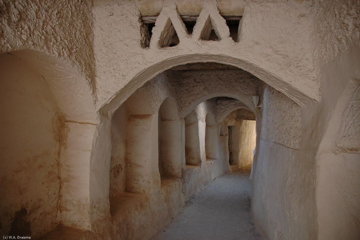
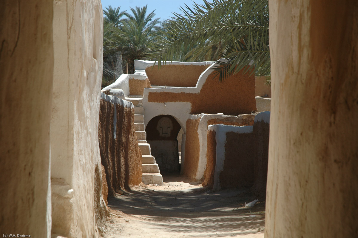
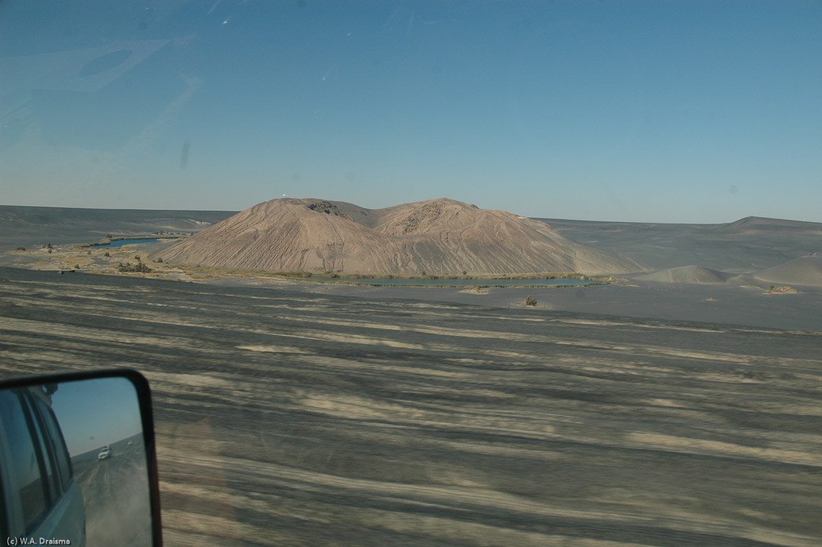
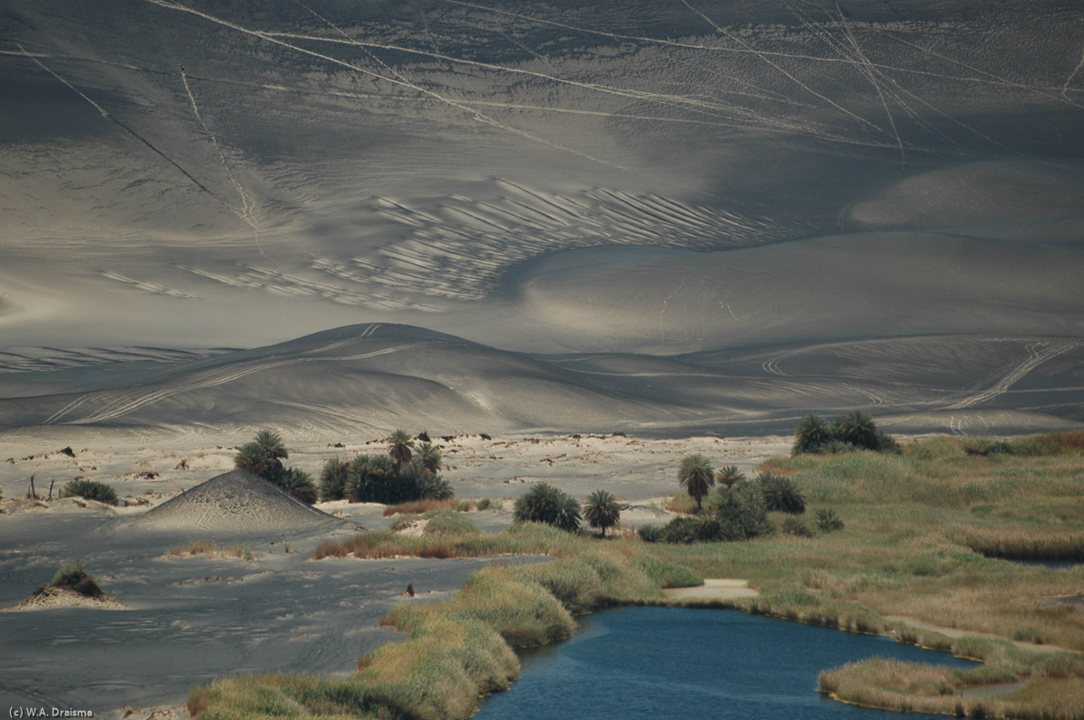
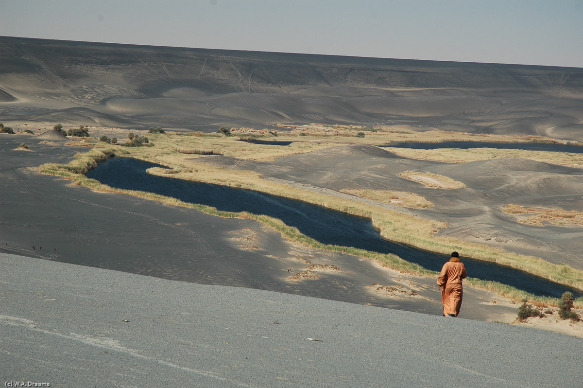
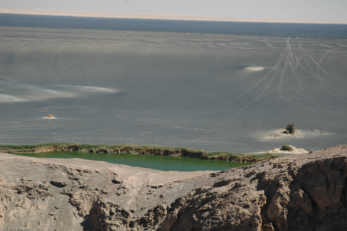
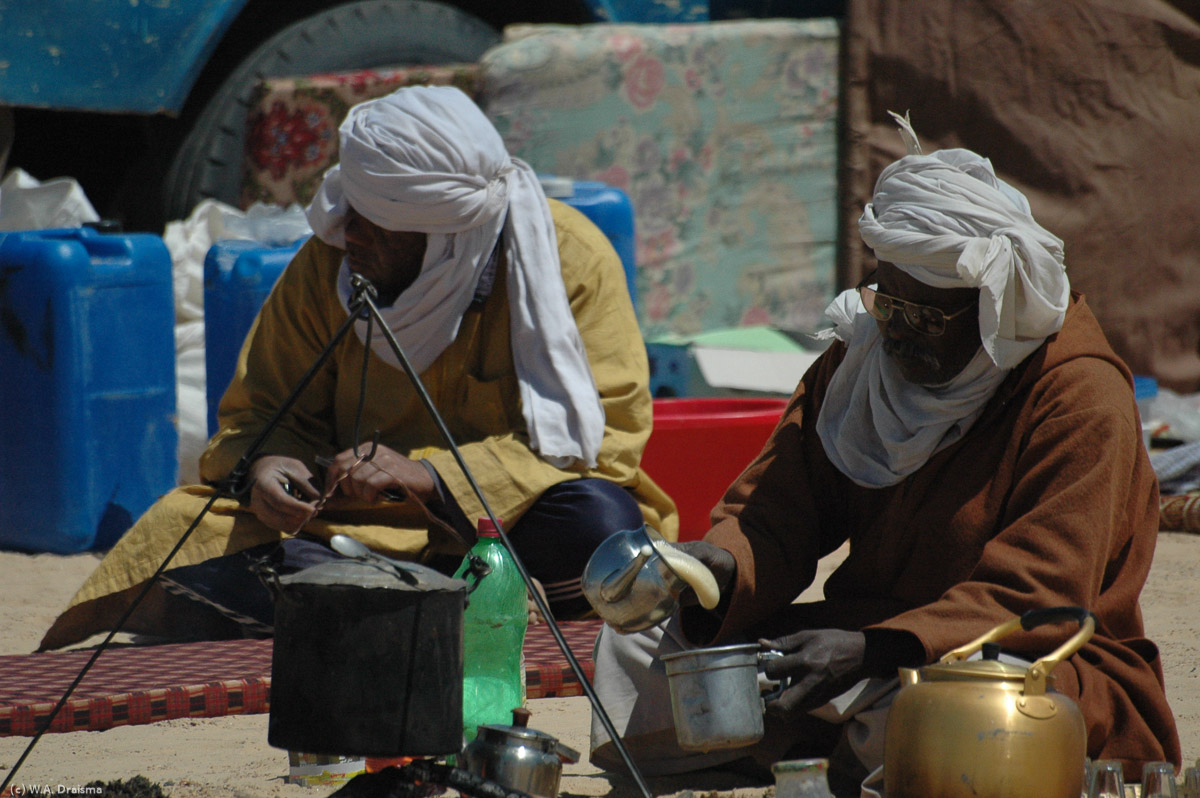
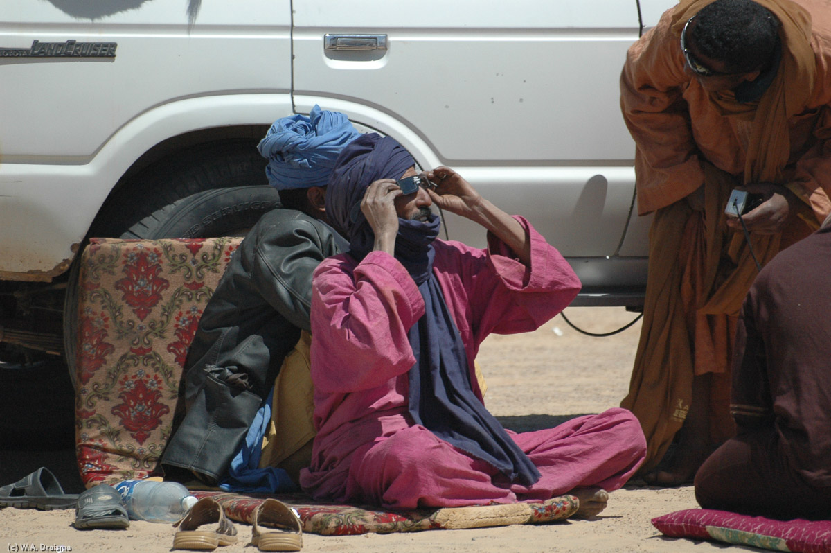
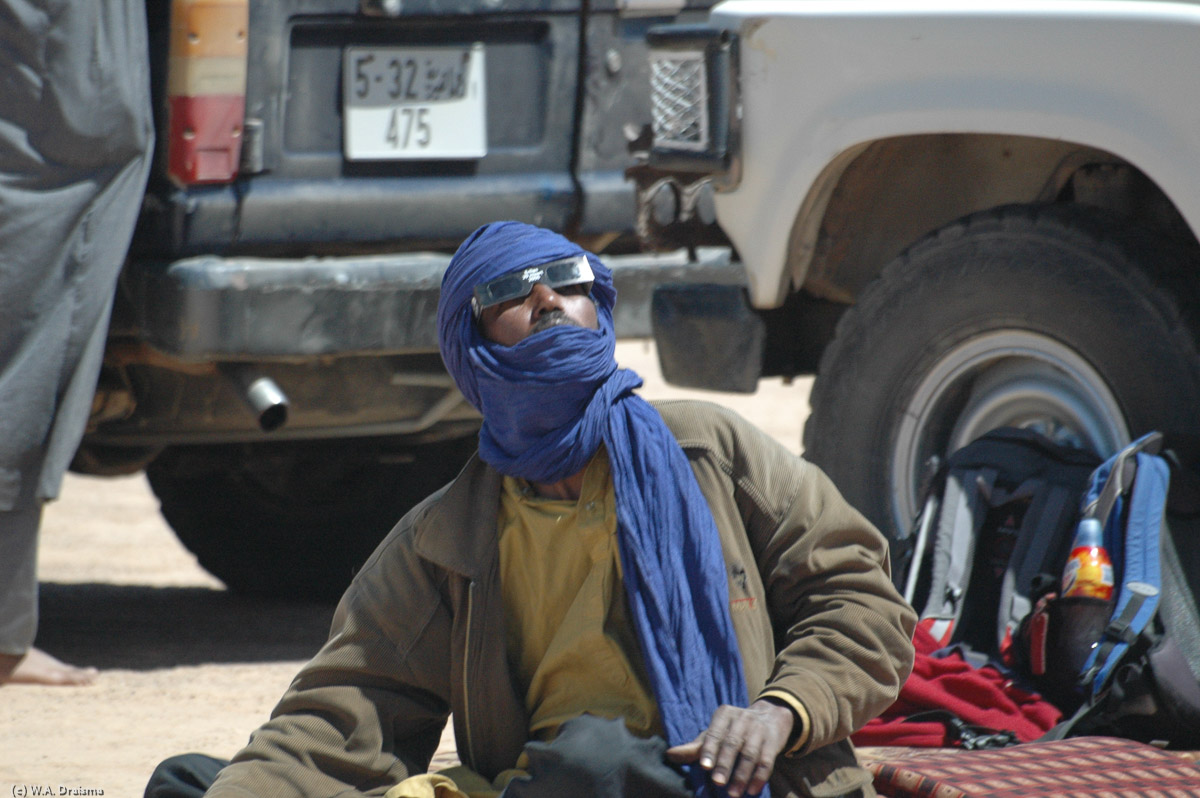
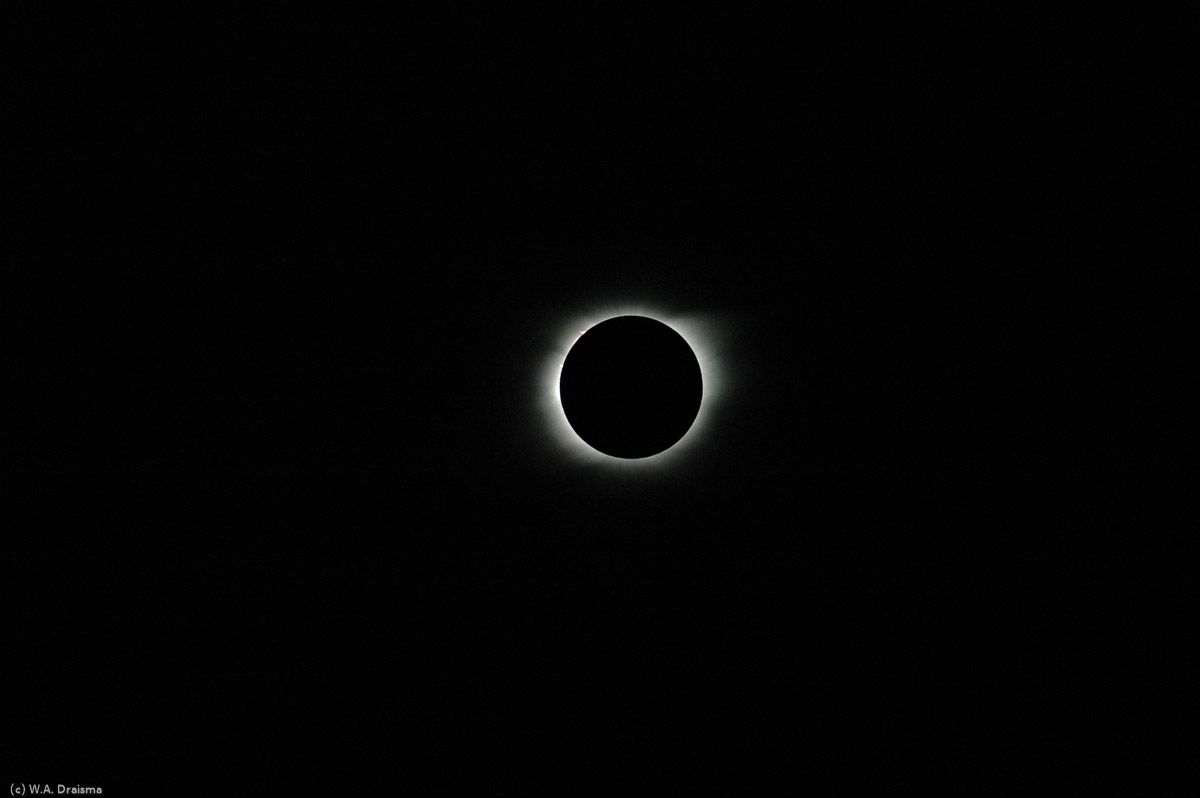
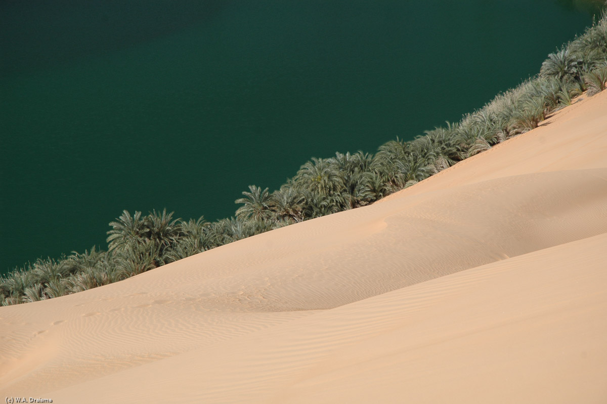
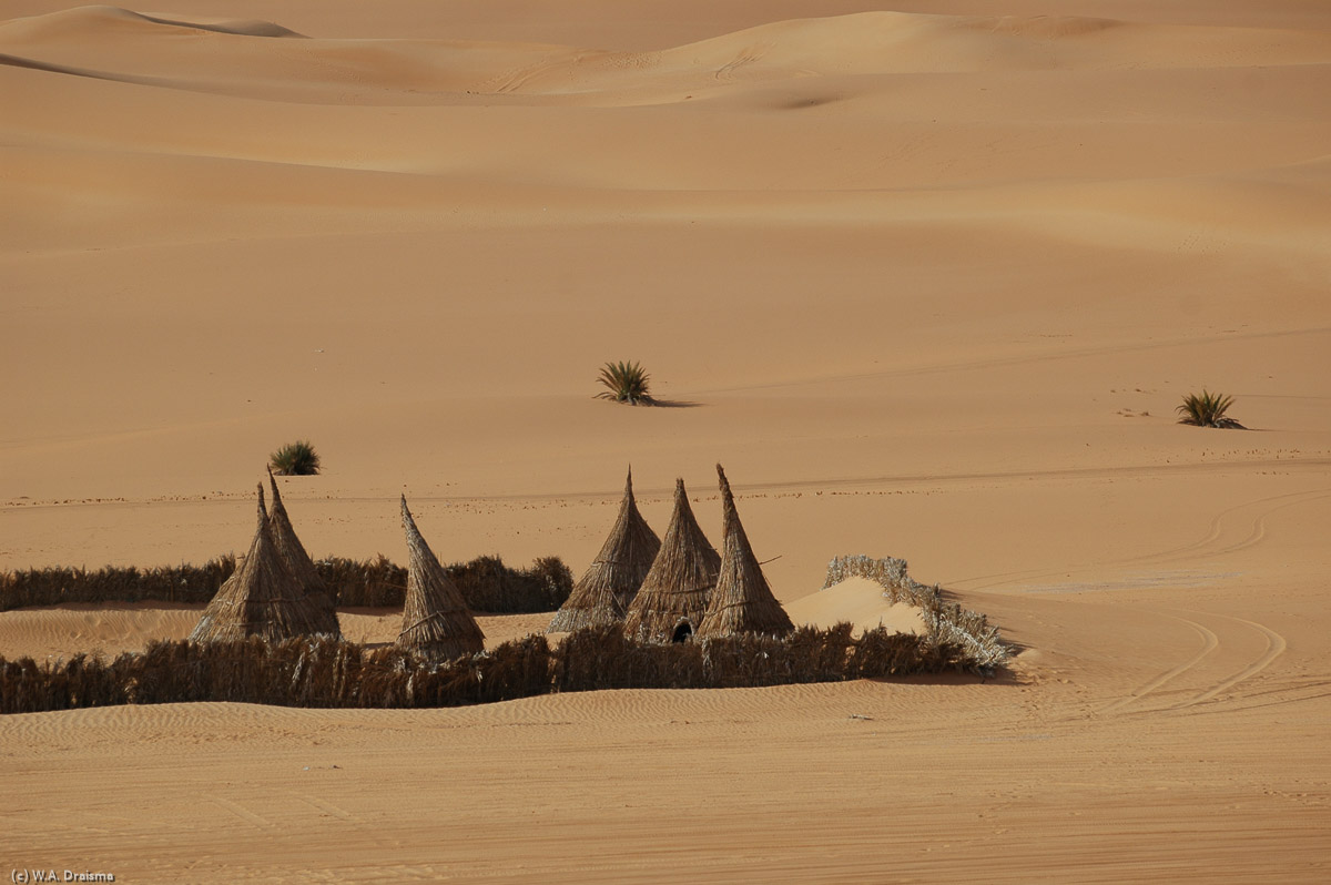
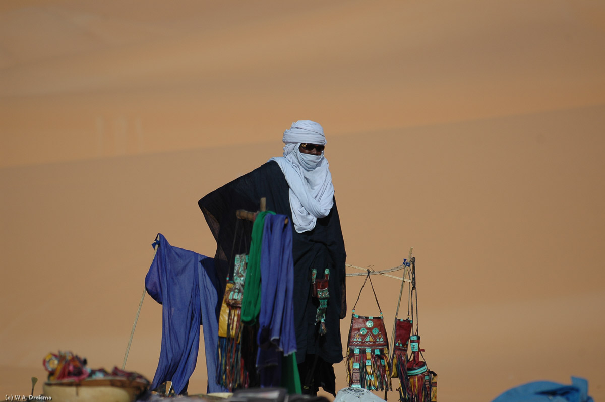
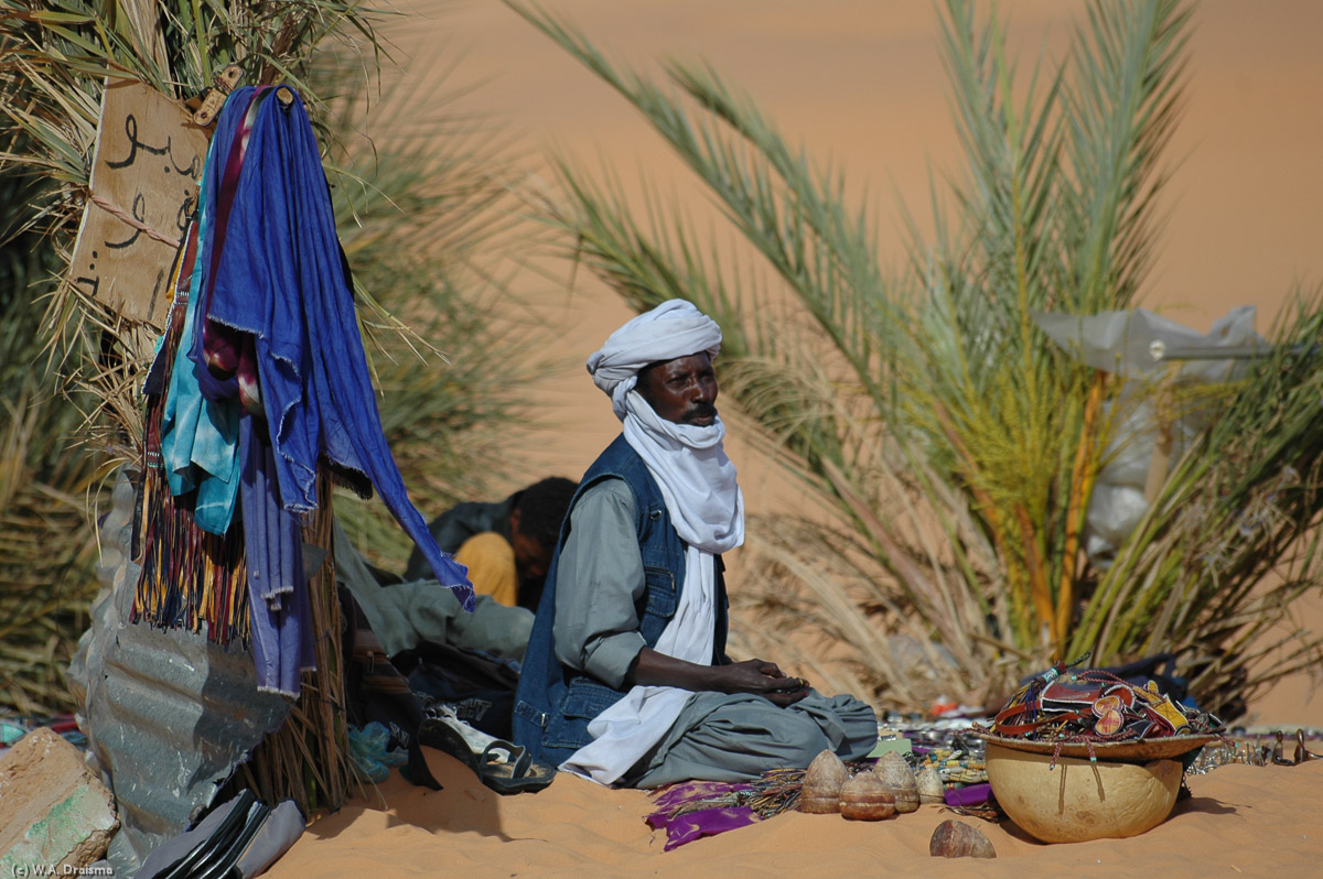
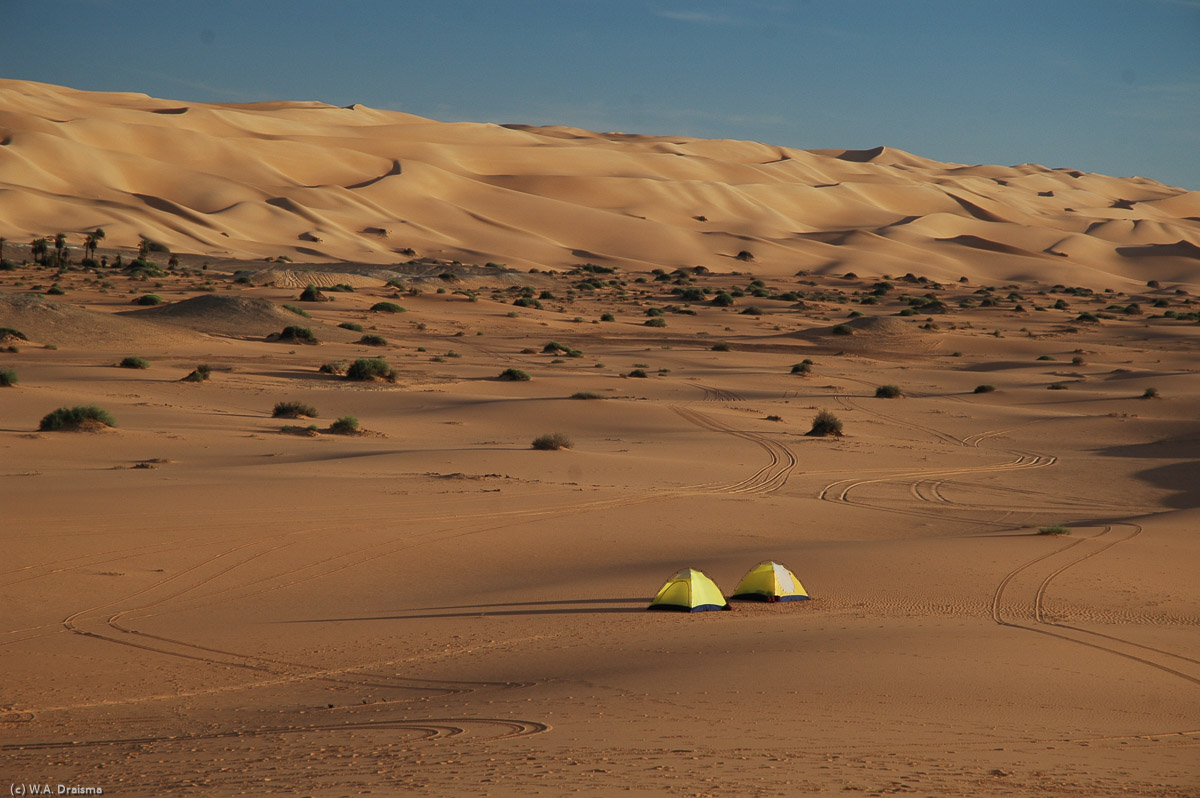
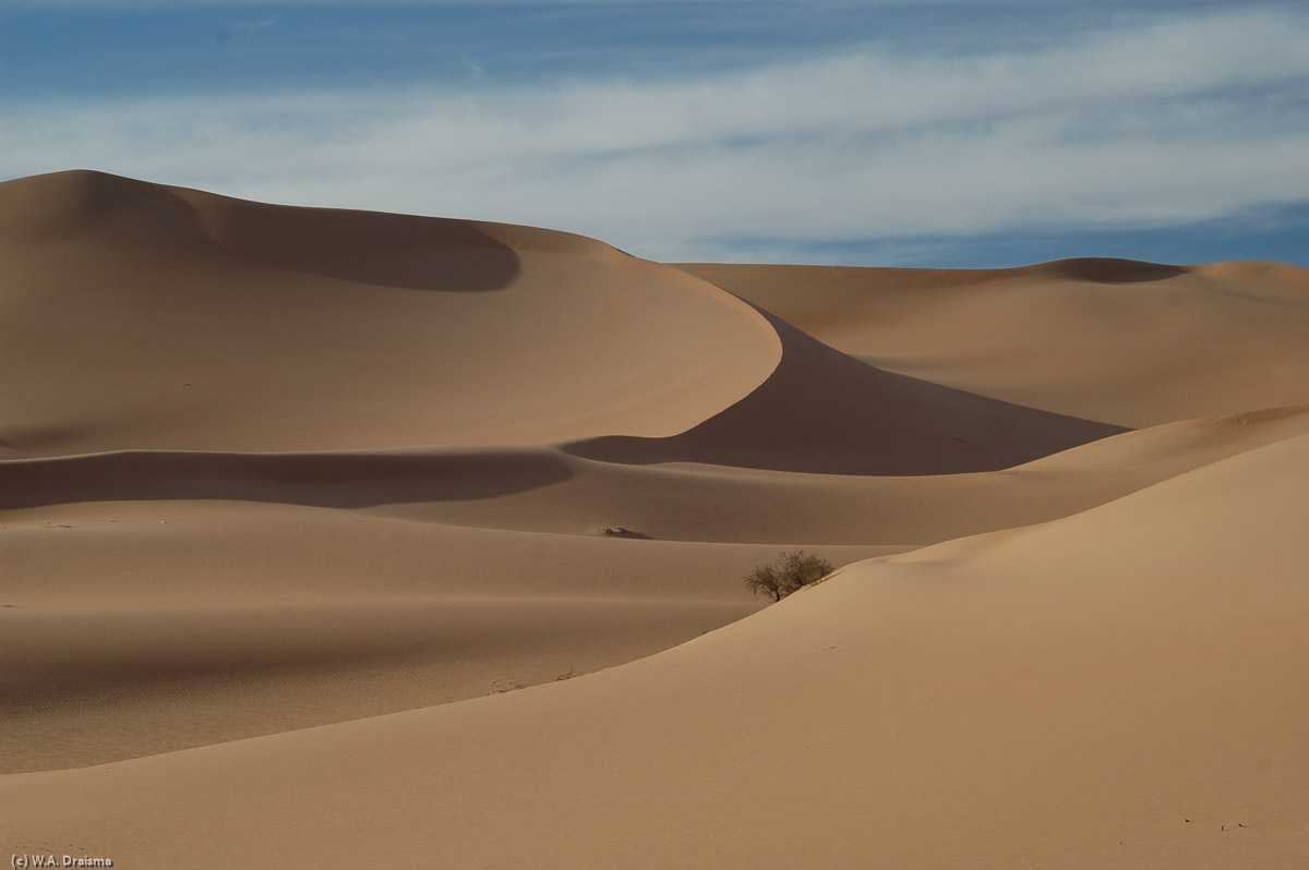
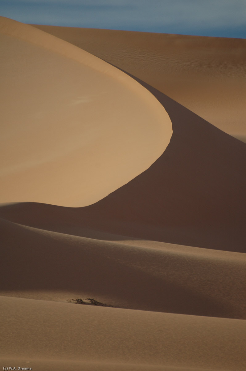
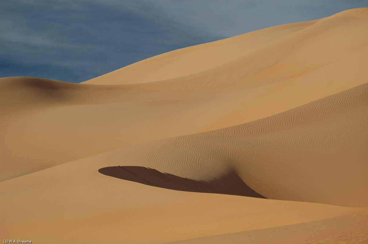
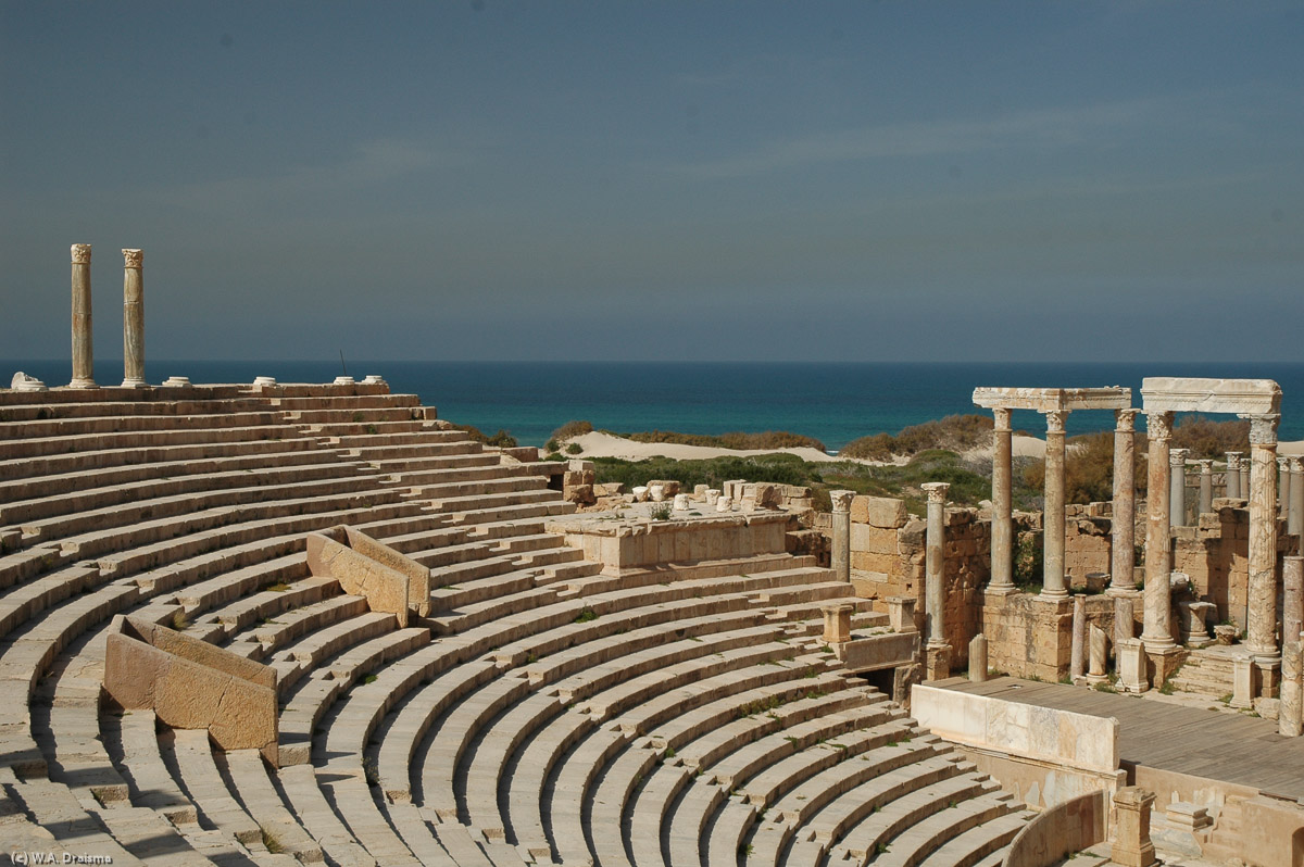
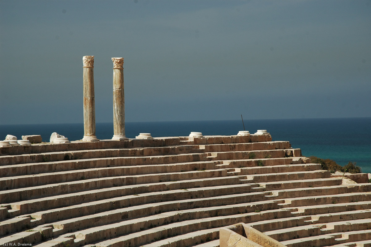
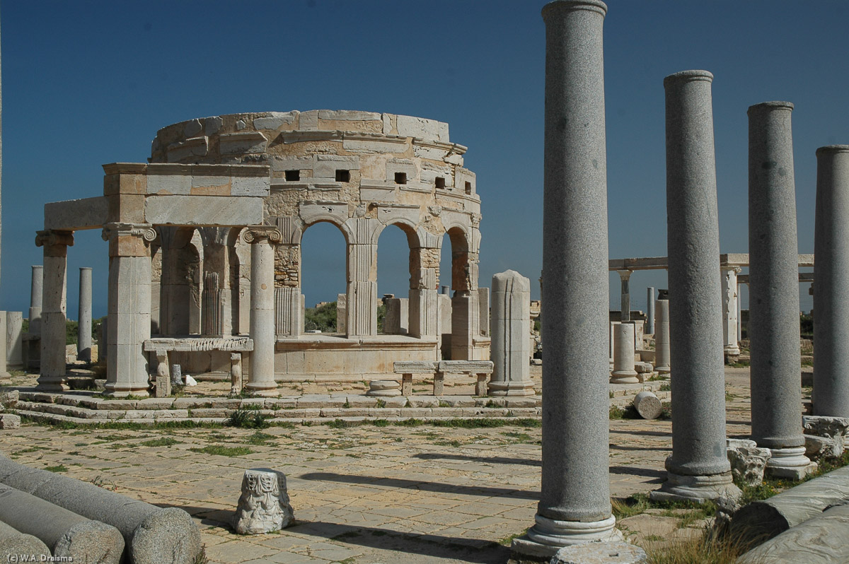
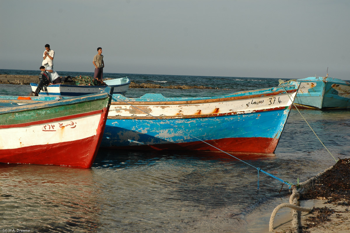
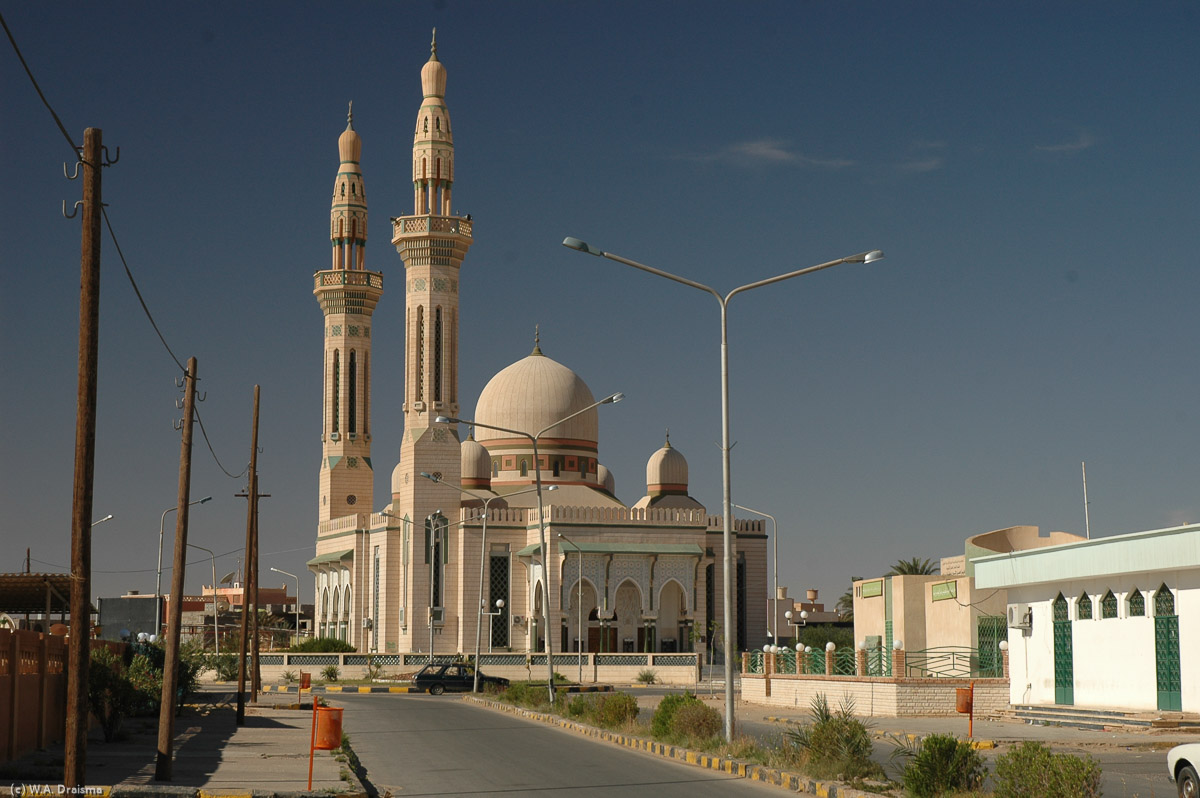
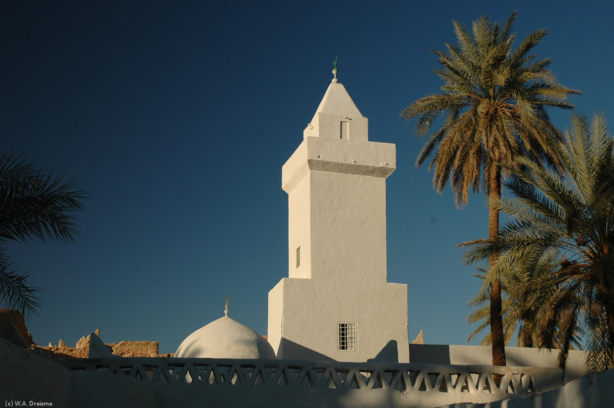
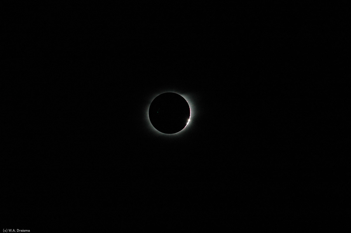
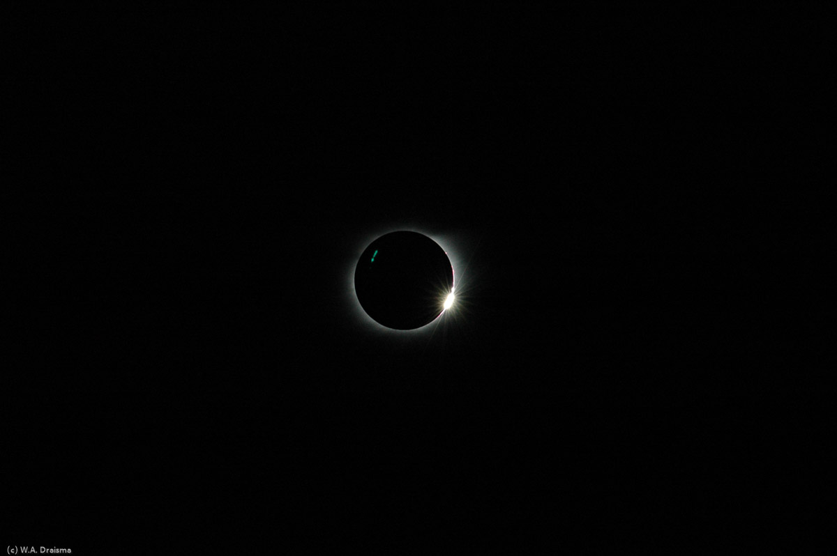
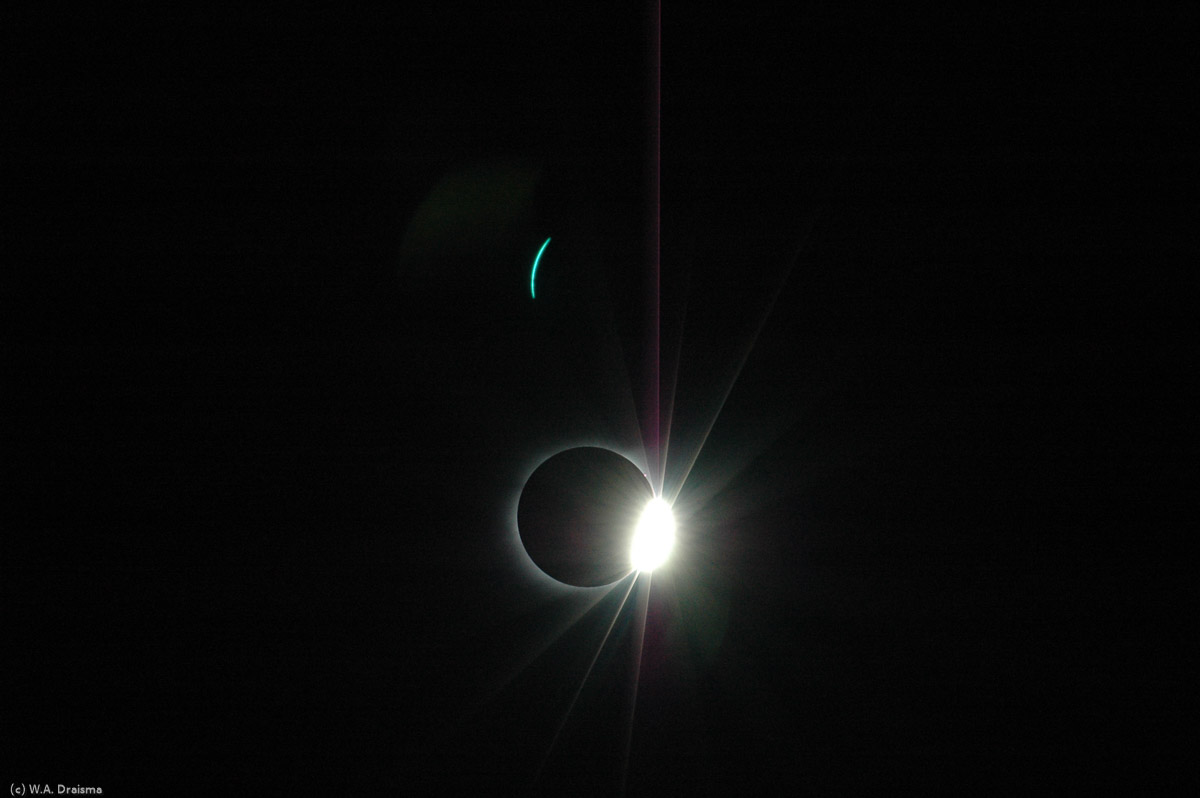
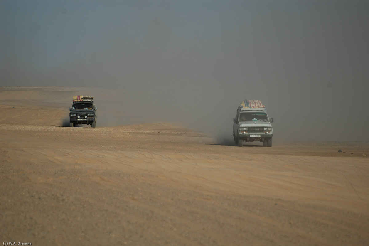
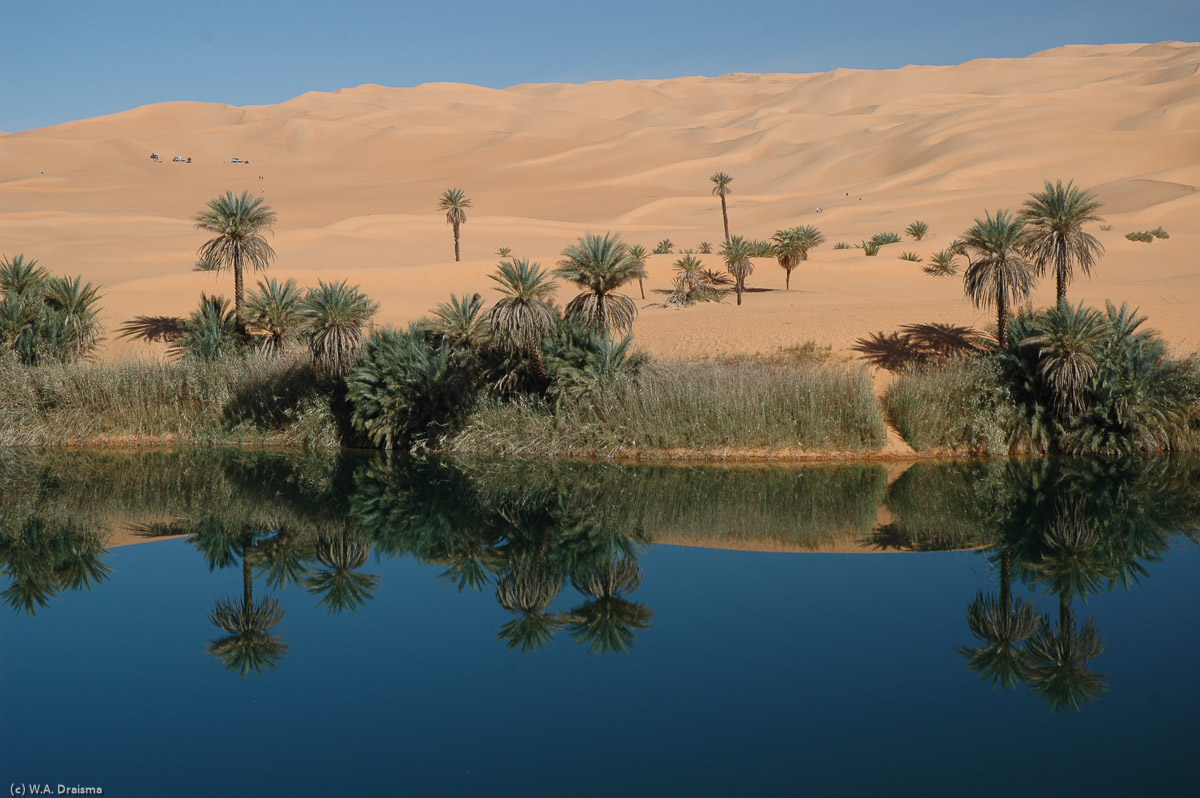
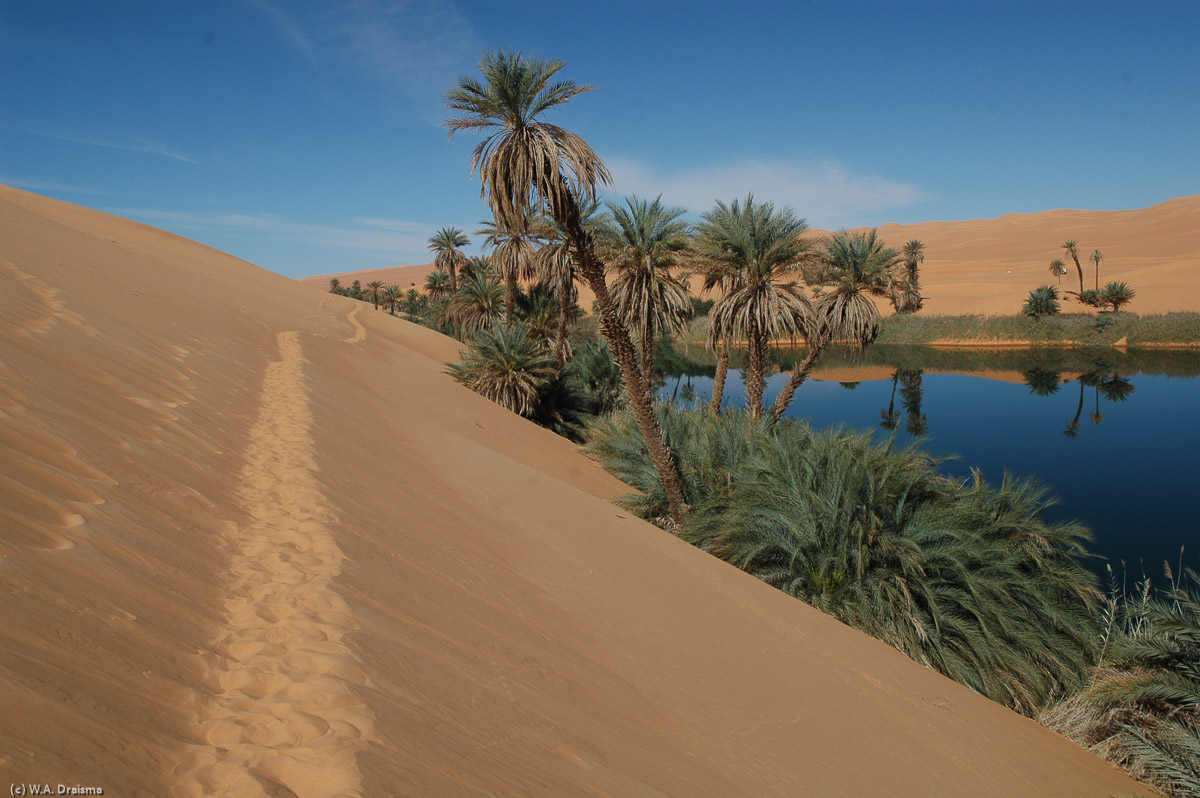
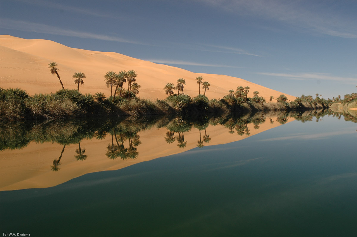
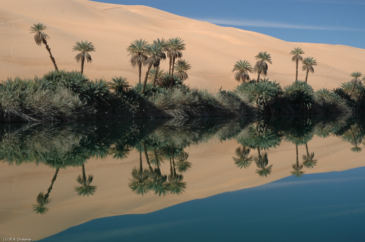
Around the World ... Libya

2006

II
Mu'ammar Gadaffi, self-proclaimed leader of the masses, 'mad dog of the Middle East', 'father of African unity', author of 'The Green Book' seized power over Libya in 1969 at the age of just 27 and was killed in 2011 following a bloody civil war. As-Saha al-Kradrah, or Green Square, is the central heart of Tripoli. Until the 1970s, the square was right on the waterfront of the Mediterranean. The main shopping and business streets radiate out from the square and on the western side of Green Square the Assai al-Hamra (Tripoli Castle), the entrance to the old city and the Jamahiriya Museum are located. Tripoli's Jamahiriya Museum, situated in the north-west corner of the Green Square, houses one of the finest collections of classical art in the Mediterranean. The entrance hall shows an elegant statue of Venus in front of a wall with mosaics from 2nd century AD. The Roman gallery on the ground floor has some superb mosaics and statues from Leptis Magna, Oea and Sabratha, the three Roman cities that formed the tri polis. The first part is dedicated to Leptis Magna and a statue of emperor Tiberius watches the visitors from his maroon alcove. Tiberius was born in 42 BC in Rome. After the marriage of his mother with Octavianus Augustus, and after a number of succesful military campaigns, Tiberius was adopted by Augustus and finally succeeded him as emperor of the Roman Empire in 14 AD. After Tiberius' death in 37 AD, his adopted nephew Caligula seized power. The floor of the smaller room connecting the Leptis Magna and Sabratha rooms is covered by a mosaic from Roman Oea. The centre of the mosaic is surrounded by a much larger area with geometric designs. Seated on cushions people could admire the portrait and scenes in the middle. As god of music, Apollo is often depicted playing his golden lyre. In one case he competed with Pan. On this occasion, King Midas had the bad sense to say that he preferred Pan's music, which caused Apollo to turn his ears into those of an ass. Just outside the Roman gallery there are some more beautiful examples of Roman mosaics. The stone archway leading into Souq al-Mushir nicely frames the Ottoman Clocktower. This is one of the main gates to the old city. Through the souq merchants and visitors entered Tripoli's medina. About 3500 people still live in the medina and about 65,000 work inside the fortified walls dating, partly, from 4th century AD. Souq al-Ghizdir, or Copper Souq, is a part of the medina where the artisan's daily work consists of patiently hammering out their wares like crescents (jammour). Maybe, insh'Allah, one day one will adorn the top of a minaret of one of the medina's 38 mosques. Souq al-Ghizdir. The Arch of Marcus Aurelius stood at the crossroads of the two most important roads of Oea, the cardo (north-south) and the decumanus (east-west). Completed in 163-164 AD it signifies the importance of Oea in the Roman Tripolis. The Gurgi Mosque is located just behind the Arch of Marcus Aurelius. The green door has some great old door knockers. The knockers of the Gurgi Mosque. Assai al-Hamra, or Tripoli Castle, was built on the site of the Roman castrum, but probably not before the Arab invasion of AD 644. Defensive walls and towers were added in the 16th century by the Spaniards and the Knights of St. John of Malta while most of the castle's interior dates from the time of the Karamanlis (1711-1835). Over the centuries the Assai al-Hamra evolved into a labyrinth of courtyards, alleyways and houses covering an area 13,000 sq meters. The part in the front now houses the Jamahiriya Museum. The former Catholic cathedral was built by the Italians in 1928 in neo-Romanesque style. In the days after the revolution, on 19 November 1970, it was converted into a mosque. The towering steeple is now the mosque's minaret. Behind the former cathedral the domed National Library. The next morning we return to Maidan al-Jazair to see the former cathedral by daylight. The domed National Library was the Royal Palace under the monarchy. After the revolution it served as the People's Palace. The triumphal Arch of Septimus Severus was built in AD 203 by the citizens of Leptis Magna to commemorate the emperor and his family. Born in AD 145 Lucius Septimus Severus spent most of his formative years in Leptis Magna and became emperor of Rome in AD 193. The arch consists of four imposing pillars supporting the domed roof. Each of the four pillars was flanked by two Corinthian columns. In between are carved reliefs showing the great virtues and successes of the emperor. The interior shows historical scenes of military campaigns, religious ceremonies and the emperor's family. Above the columns are panels showing triumphal processions, sacrificial scenes and Septimus Severus holding the hand of his son Caracalla. Leptis Magna is one of the finest Roman cities in the Mediterranean. Its rise to eminence started under emperor Augustus and soon it became one of the leading ports in Africa. Successive Roman emperors continued to decorate the city with exceptionally rich public buildings. By AD 300 however, its glory days had passed and the AD 365 earthquake accelerated its decline. Following the arrival of permanent water and marble in Leptis Magna, emperor Hadrian commisioned the building of the superb Hadrianic Baths. Opened in AD 137, the baths soon became one of the social hubs in the city. The firigidarium, or cold room, measured 30 by 15 m and the vaulted roof was supported by eight massive cipolin columns. The room was paved with marble and there were pools at either side. The Chalcidicum lies west of the Arch of Trajan and its colonnaded portico was reached via steps from the Via Trionfale. Built during the reign of emperor Augustus it contained a small temple honouring both Augustus and Venus. The Temple to Rome and Augustus was one of three temples at the old forum. It was built of limestone and may have served as a platform for speakers addressing crowds in the square. The old forum was Leptis Magna's first city centre. Paved in AD 2 and surrounded by colonnaded porticoes on three sides it was allowed to fall in neglect when emperor Septimus Severus shifted the centre of the city to the new forum. The Severan Basilica was originally a judicial basilica rather than a church. Started by Septimus Severus and finished by his son Caracalla in AD 216, it measured 92m long and 40m wide. Converted to a Christian church by emperor Justinian in the 6th century, it ran along the north-eastern side of the Severan forum. The Basilica contained two apses at either end, a nave, aisles divided by red-granite columns and possibly a wooden roof. The relative austerity of the main hall stands in marked contrast to the extravagantly sculpted pillars at either end of the Basilica. Winged lions on top of the Basilica's apses. Inscription on one of the Basilica's stone remnants. Following his victory over the Parthians in AD 202-203 Septimus Severus returned to his native city with a grand vision to turn Leptis Magna into a city that rivalled imperial Rome. This involved reconfiguring the heart of the city, moving it away from the old forum to the new one that bore his name. The marble covered open-air Severan Forum measured 100m by 60m and was surrounded by collonaded porticoes. On the facades between the arches were Gorgon heads. Most were symbolic representations of the Roman goddess Victory but there were also some Medusa images and a few sea nymphs. The theatre of Leptis Magna is the oldest stone theatre anywhere in the Roman world. It was built on the site of a 3rd - 5th-century BC Punic necropolis. Begun in AD 1-2 it is the second largest surviving theatre in Africa after Sabratha's. The stage with its facade of semicircular recesses surrounded by three-tiered fluted columns dates from the era of Antoninus Pius (AD 138-161). The stage was decorated with hundreds of statues and sculptures of emperors, gods and wealthy private citizens. The VIPs of the city were seated just above the orchestra, separated by a solid stone banister from the rest of the paying customers. At the back of the cavea, or seating area, were some small temples and a collonade of cipolin columns. Built in 9-8 BC, the market was the place were Leptis' merchants and farmers sold their goods. Two octagonal halls, where stalls were set up, are reconstructed. This hall was probably the section for fabrics while the other was used for selling fruits and vegetables. There were more stalls in the collonaded portico that surrounded the market. On our way to Misrata we make a stop to visit the largest coastal sand dunes in the world. Either they're not so high, or we couldn't find them. We only found a couple of fishermen. We did see a "dune" covered with rusty anchors though. An-Nahr Sinai, the Great Man-Made River Project is one of Colonel Gadaffi's most ambitious development projects, bringing fresh water from Saharan aquifers to coastal Libya. Stage one is completed, connecting two wells in the Tazerbo and Sarir Basins to the coastal area from Benghazi to Sirte. At the completion of stage five there will be over 4000 km of pipes, many up to 4m in diameter and buried in trenches nearly 7m below the ground, with a daily capacity of six million cubic metres. There is serious criticism too including fears that lowering the ground-water levels will severely impact agriculture in Libya. Qasr Libya has one of he best collections of Byzantine mosaics in the country. They were laid on the floor of a Byzantine church in AD 529-540 during the reign of Justinian I in the village of Olbia. A total of 50 mosaic panels were found in Qasr Libya. They cover a wide range of subjects and are grouped into diverse sets of five. The Byzantine inscription on this panel states that the mosaics were laid in AD 539. The river god Geon hangs in a group representing the Four Rivers of Paradise with the nymph Kastelia of Delphi in the middle. Apart from Geon the Four Rivers of Paradise are represented by the river gods Physon, Tigris and Euphrates. As everywhere in Libya, Colonel Gadaffi is also omnipresent in Al-Bayda. Al-Bayda is a pleasant city on the northern fringe of the Jebel Akhdar. Al-Bayda was one of the main strongholds of the Sanusi Movement during the Ottoman period and it was the administrative capital during the reign of King Isidris. The modern, white Bilal Mosque has an attractive onion-like dome flanked by four smaller domes, as well as two piercing minarets. The Bilal Mosque by night. Larger than the Parthenon in Athens, the Temple of Zeus in Cyrene reflects the city's importance in the ancient Greek world. Built in the 5th century BC it was used as a temple to Jupiter during the Roman occupation, destroyed during the Jewish revolt in AD 115, rebuilt by Roman emperor Hadrian in AD 120 and devastated by the AD 365 earthquake. The Temple of Zeus measures 32m by 70m and was surrounded by two rows of eight and two rows of 17 Doric columns. On the main platform was a statue of a seated Zeus holding Victory in his right hand and a sceptre in his left. The Gymnasium was originally built by the Greeks in the 2nd century BC as the major sporting building of Cyrene. In the 1st century AD it was converted into a forum by the Romans to be used for political meetings. The open palaestra or excercise area, used for races and other sporting contests, was surrounded by Doric columns on four sides. Claudius Tiberius Jason Magnus was the high priest of the Temple of Apollo in the 2nd century AD. The remains of his private residence are impressive: marble floors, the superb Four Seasons Mosaic, finely sculpted female figures in marble clothes, etc. etc. The main road through Cyrene was known as the Skyrota. It is still lined with impressive columns. During Roman times it became a monumental passageway linking the forum to the agora. The western end of the Agora holds the Sanctuary of Demeter and Kore. It is an unusual circular structure and the temple was the scene of a riotous, women-only annual celebration. As part of the festivities, the women of Cyrene proceeded from here to the Temple of Demeter outside the city walls. Demeter and Kore are both goddesses of fertility. Kore was the daughter of Demeter and Zeus. She spends six months a year with Hades, god of the underworld. This results in autumn and winter on earth. When Kore returns to the upperworld, spring comes and everything starts growing again. In the cliffs beneath the agora public baths were carved out. Seated and with space to store belongings (or oil lamps) overhead bathers could wash their troubles away. The Temple of Apollo was one of Cyrene's earliest temples. The foundations date from the 6th century BC but the temple as it is visible now is essentially a 2nd century AD Roman building in Greek Doric style. Immediately in front of the temple is the monumental altar. It measures 22m in length and it is made of limestone covered with marble slabs. Religious rites, including animal sacrifices, were caried out here. Cyrene, the capital of the Greek pentapolis, was founded in 631 BC by Greek settlers from Thera (Santorini). By 388 BC Cyrene was a great cultural centre. In 331 BC Cyrene was conquered by Alexander the Great, followed within a century by the Ptolemies who finally, in 96 BC handed Cyrene over to the Romans. Apollonia was the harbour for Cyrene. It lies 18km west of Cyrene. Archaeological evidence suggests that Apollonia was already operating as a port as early as the 7th century BC. Most of what is visible today dates from the Byzantine era when Apollonia was known as the city of churches. It had five basilicas and 19 towers. Over the hills to the east of Apollonia is the plunging Greek theatre , which stood outside the walls of the ancient city. Nature slowly reclaims the remains of the ancient city of Apollonia. The Eastern Church once was the biggest church in Cyrenaica. Only a couple of cipolin columns remain standing today. The marble was shipped from the Greek island Paros while the granite slabs came from Egypt. Although the name Qasr means castle, Qasr al-Haj was rarely used as a form of defence. Instead it was built as a place to store the harvests of the surrounding area in the second half of the 12th century by As-Sheikh Abd-'Allah ibn Mohammed ibn Hillal ibn Ganem Abu Jatla, or simply Sheikh Abu Jatla. Entering Qasr al-Haj is like wandering into a man-made canyon. Constructed from local rock and gypsum, the structure counts 114 storage rooms, cool areas sealed with doors made from palm trunks. This warded of insects, thieves and bad weather. The purpose of the Qasr was comparable to a modern bank, saving goods for less favourable times. The walls of the main courtyard are completely surrounded by cave-like rooms. There are three storeys above the ground and one below. Each storage area is about 2m deep from the door to the back and some are subdivided into pens for different crop types. A ledge circles the Qasr's top level. The ledge offers both a spectacular view over the surrounding area as well as access to the storage rooms, some of which are still in use. At a couple of points there are the remains of ancient winches used to pull goods from the ground to the upper storage rooms. On our way from Tripoli to Ghadames we pass the small town of Nalut at the western end of Jebel Nafusa. As in many other towns we see an arch with a reference to Ghadaffi's green books and, in the distance, the Colonel himself. Nalut, like many other towns in the Jebel Nafusa, also has a Qasr. But unlike the qasrs at Qasr al-Haj and Kabaw, the storage rooms in the Qasr Nalut doesn't face an open courtyard but instead are tightly packed and overlook two narrow thoroughfares which gives it the feel of a small, fortified village. The qasr was built in AD 1240 over an older structure. The larger rooms belonged to richer merchants or farmers while others were shared by several families. There were a total of 400 rooms and the keeper always knew how much each family had in storage at any given time. The qasr's interior is strewn with old pieces of pottery one used to store dates, wheat, oil and barley. Many of the rooms, of which the last ones fell in disuse in 1960, are still closed by palm-trunk doors. Several also show inscriptions like the crescent moon, a start and the hand of Fatima. The inside of Qasr Nalut is reached through a covered tunnel, used to regulate the entry to the inner sections during the old days. A display of the goods that used to be stored in the qasr forms a welcome meal for a qute tiny mouse. The circular platform and crushing stone of the ma'sered zeytoun, or olive press, of Nalut. It was still in use until 2000. We continue on our way to Ghadames and stop in the sleepy town of Derj, 210 km south of Nalut. We're greeted by the Colonel who reminds us that in Lybia you'll never need to be alone. A Tuareg reading in the shade. Surrounded by the Hamada al-Hamra lies the oasis town of Ghadames, the jewel of the Sahara. Its old city, a Unesco World Heritage site, is by far the largest and best preserved in Lybia. Although the old city is deserted now, it once was one of the most significant trading posts in the northern Sahara. We enter the old city of Ghadames through Bab al-Burr, the entrance used by the inhabitants. Strangers normally entered through a different gate to prevent them from directly entering the residential areas. At the end of the covered passageway from Bab al-Burr we enter Jarasan Street, which runs deep into the heart of Ghadames. Walking between whitewashed walls, we soon enter Jarasan Square through an attractive archway framing the minaret of the white Omran Mosque. Jarasan Square was the meeting place for one of the sub-families of the Bani Wazid, roughly one-seventh of the city's men. Jarasan Street is one of the seven sections or 'streets' of Ghadames. Each 'street' was like a self-contained town with a mosque, houses, schools, markets, a small communal square and a gate. Each section was inhabited by a sub-family, or tribe, of the Bani Wazid or the Bani Walid. From Jarasan Square we continue through the covered section of the old city. It is remarkebly cool and all illumination comes from evenly spaced skylights, some as high as 10m, which are surprisingly effective. Well into the 1980s, a few thousand people were still living in the old city. Nowadays, only one family remains. Most of the Ghadames doors are made of palm trunks split in two to form planks. Every now and then, a door is decorated by small leather studs in bright red, green and yellow (the colours of Ghadames indicating that the owner of the house has made the haj pilgrimage to Mecca. The wooden padlocks seen on several doors are an early form of our present day locks. They could only be opened with a key with pins in the right places. The houses in Ghadames were made of gypsum and sun-dried mud brick with ceilings reinforced with palm trunks. Moving away from the city's heart, the densely packed houses gave way to gardens with the city all beyond. Many of the gardens surrounding the covered areas of the city are still in use. Also the houses are still in the posession of the original families and many return regularly to carry out maintenance. Some even move back into their old houses within the cool walls of the old town during summer. The built-up areas of old Ghadames were divided into two main sections representing the two major families of the region: the Bani Walid and the Bani Wazid. The three sub-families of the Bani Walid lived in the quarters north of the main square while the four sub-families of the Bani Wazid lived south of it. Almost every thoroughfare is lined with sitting benches that are a good place to rest. Even on the hottest days in summer, the covered areas remain cool. Ghadames used to be one of the principal trading centres of the Sahara. Having hardly any product of its own, Ghadames became one of the great entrepot towns for goods from all over Africa. Precious stones and metals, ivory, dates and ostrich plumes went north while glass necklaces, paper, pearls and linen went south. The pattern of alternating upright and inverted triangles is found across the Sahara of western Lybia as far south as Ghat. One legend claims that they represent the crown of an ancient Berber queen who ruled over the desert. Via the Ain al-Faras, the Well of the Mare, we return to Omran Mosque. According to legend Ain al-Faras was the place were a horse of a ancient caravan of travellers pawed the ground resulting in fresh water rising to the surface. Because they had lunch there the day before they called the place ghad (i.e. lunch) ames (i.e. yesterday). The madrassa was the place for the Quran and islamic law to be taught. The tower of the old madrassas lit by the setting sun. While the last rays of the setting sun are casting their soft light on the minaret of Omran Mosque, we say goodbye to Ghadames, jewel of the Sahara. Tomorrow we'll leave for Sebha, a long monotonous trip of more than 800km. Today we've a long day of travel in front of us. Nearly 900 km of tar between endless seas of sand. Only our occasional stops relieve the monotony. Tracks of a desert beetle. After a long drive we finally reach the neighborhood of Sebha. Already the shadows lengthen and the light from the sun is turning to gold. Another 50 km to go. Along the road to Sebha. The next morning we leave from Sebha. We're not the only ones. As the date of the solar eclipse comes near many people have arrived at Sebha and are now departing. As it is about 500 km to our final destination with only a few refuellling stops, we'll have to refuel everywehere we can...as is true for all the others as well. The longest distance we'll have to travel without possibility to refuel is about 800km through the sands of the Sahara. The road is surfaced up to the tiny town of Tmissah. This is also the last place to refill. Already on the outskirts of Tmissah we enter the sands and it doesn't take long before we get stuck for the first time. We don't travel far on our first day. Still within a few km from Tmissah we stop for the night. Apparently we're not the first who have chosen this spot as a place to camp. Hopefully our fate will be different. The first few hours of the second day we travel over flat stretches of sand. Then the landscape changes when the Mehershema Plateau comes into sight. Present day Sahara once was covered by forest, scrubs and savanna grasses. Not surprisingly it was also teeming with wildlife. It's only about 8000 years ago that the grasslands began to give way to desert as the till then regular rainfalls became rare. This is how it must have been till 6000 BC when the Sahara was still green. Now it looks like a fata morgana, even to our drivers who pose for their own pictures. But it is real, created by water pumped up from underground reservoirs stored for millennia in porous rock between impermeable layers. Around noon on the third day we reach Waw an Namus, one of the most remote places in the world, standing at the centre of the Sahara just under 300km from Tmissah. The now-extinct volcano of Waw an Namus is surrounded by three beautiful lakes, a blue one, a red one and a green one, each surrounded by high reeds and fine black and white volcanic sand. The sights from the rim of the crater are spectacular but of course it's even better to get down to the bottom of the crater. Downhill through the soft black sand is easy, only 10-15 minutes to the bottom. Close to the water the number of mosquitoes rises not strange for a place nicknamed Crater of the Mosquitoes. The middle of the crater has a volcanic cone rising well above the crater rim. The climb up is not difficult but the temperature nevertheless makes it a strenuous affair. From the top of the cone there are some spectacular views over the surroundings. Opposite blue lake is green lake. Viewed from the top of the crater's cone the lake is an emerald green looking strangely out of place amidst the black volcanic sand. Unfortunately the opposite crater wall shows many scars caused by the tracks of other visitor's 4WDs. Far below other visitors of Waw an Namus make their own strolls over the crater floor. Although Waw an Namus is one of the most remote places on earth and although it requires quite some effort to visit this place, the number of other visitors is enormous. Tens of 4WDs pass by on the crater's rim, all on their way to the coming eclipse's central line. Unfortunately quite a number of visitors cannot resist the temptation to drive down into the crater scarring the landscape for many years to come and spoiling the experience for those that will come after them. Climbing out of the volcano is hard work. Every step up the slope of the crater results in sliding half a step back down again. Meanwhile the sun's burning high in the sky. Many short stops later we're out and both lunch and drinks are waiting for us. After lunch it is time to leave Waw an Namus for our final destination, the eclipse's central line close to Bir al-Maraf. With a last glance at this great site and while a helicopter flies over delivering some VIP's from a nearby eclipse-camp to the craterfloor we leave. Travelling eastwards, the black volcanic sands of Waw an Namus turn brown again. For the next hours we travel through a flat monotonous landscape only stopping at a water well to refill our supply of drinkable water. Rumour has it that there's a camp set up by the governement in which all visitors must stay. When we indeed see a camp, we turn into a different direction. It doesn't take long before we're halted by a van with a machinegun on top: the Libyan desert police. We ask for permission to camp elsewhere but have to wait while this is being discussed somewhere higher in the hierarchy. It takes more than an hour to come to a decision but finally we're escorted to a place where we're allowed to camp. A perfect spot: 24°29"47.6' North and 17°55"53.3' East, only a few hunderd meters from the central line. We set up camp and relax. At the horizon we notice a police car and the lights of the official camp. We've made it in time and we're at the right spot. Only one night separates us from the solar eclipse of March 29. Let's hope that the blue sky will be there tomorrow as well. The only real threat is a dust storm. It s the right season... Apart from a rather strong wind that blows sand particles over the camera equipment it's a fine day. Blue skies and nothing to be seen around us except for "our" police car at the horizon. Now it's a matter of waiting until first contact. At 10:50 AM (+2 GMT) there's a small but clearly visible bite out of the sun's disk. The moon has passed first contact. In about 90 minutes time this bite will grow until at second contact the moon will entirely cover the solar disk. Up till this moment camera's and eyes need to be protected with a high density solar filter. While we're excitedly waiting for the moment supreme, our drivers don't seem to bother. They have breakfast and seem oblivious of the fuzz around them. Some don't care, some do but are afraid of what will happen. The first hour or so nothing seems to change but then the light starts to become weaker. Curiosity wins from fear and one by one our drivers watch the disappearing sun. Even the most anxious of our drivers now casts a quick glance at the sun. A few seconds, not more. But we're glad that instead of lying under a car with his eyes shut, he'll whitness this remarkable phenomenon, probably for only once during his lifetime. At 12.18 AM light fades away quickly and totality is there. The remaining light is an eerie, cold light. The horizon is brighter then its surroundings just like early in the morning before sunrise. But instead of being brigther only in the east (in the morning) or west (in the evening) the entire horizon is bright. After 4 minutes of darkness, illuminated only by the sun's corona and some red prominences, huge flames of hot gas that radiate outward from the sun's surface, hundreds of thousands of kms long, the sun reemerges from behind the moon shining through valleys on the moon's surface at first: Bailey's Beads. The first ray of the sun's light (or last) that reaches earth through a valley on the moon's surfaces results in the so-called Diamond Ring. As the eclipse ends, more rays reach earth resulting in the so-called Bailey's Beads or String of Pearls. More and more light of the sun reappears from behind the moon. The light is already too bright to look at it directly with the naked eye and reflections appear inside the camera's lense system. It's time to put on glasses again and put a fliter over our photographic equipment. The eclipse is over! Right after the eclipse is over we leave for the return journey. We're not the onlye ones. Tens of 4WDs speed towards the civilized world again kicking up dust into the air. At a certain moment in time we even drive in a sort of traffic jam, even though there's no real road. In the dust visibiblity regularly becomes zero and with the velocity at which we drive a sudden bump could launch us in the air. A landrover of a different group tipps over resulting in two wounded people. The next day the traffic becomes lighter again. We're not in a hurry. The landscape is flat as far as the eye can see. And then, suddenly, there's a lonely tree offering a nice and shady spot. A perfect place to have lunch. There must be some water undergound. An old wadi maybe? And then, in a very soft stretch of sand, one of the cars gets stuck, the first time again since a number of days. The others get through without problem although the driving isn't easy. Amazingly, we've even see a few normal cars that apparently have got through till here and even further. At the end of the day we reach Tmissah again. There's a long line at the gas station and we have to wait for over an hour before it's our turn to get fuel. From there we drive a little back again and set up camp just outside town. This beetle looks similar to the Toktokkie beetle of southern Africa's Namib desert. The Toktokkie collects water through condensation of dew on its shield. Will this beetle use the same technique? An old jeep with some friendly Libyans passes by. Although sand and dunes dominate, there are quite some date palms around Tmissah. The dunes pose a challenge of their own. Some of us try to use a plate as a kind of sand board. The result is trousers filled with sand. We have to find some better way to slide down the dunes. The silhouet of a date palm stands out against a golden sky. Zueila, or Balad ash-Shareef as it was called in the old days which means Town of Chiefs, was a rendezvous point for caravans. It already had a cathedral, mosque, bath and markets in the 11th century. Its main attraction is a set of seven tombs, known as As-Sahaba. The tombs of As-Sahaba belong to a group of the prophet Mohammed's contemporaries who died here in a battle to defend the town in the 7th century. The tombs have been restored to something like their original appearance. Our next destination will be the Ubari lakes in Idehan Ubari. On our way we pass Murzuq, another famous place in caravan history. A few kms past Murzuq we leave the road and set up camp between the sanddunes. Bilal (right), our travel agent, and Grandpa (left), the boss of the crew look at us. A dune rippled by the wind. It's only half a day of travel. Then we'll enter the Idehan Ubari to visit the famous lakes. Teddy is one of the drivers. We call him Teddy because he looks like a giant teddybear. His real name is too difficult to remember. The Idehan Ubari, or Ubari sand sea, is one of the highlights of a trip to Libya because of the presence of a number of idyllic palm-fringed lakes set in a spectacular scenery of high dunes. We enter the Idehan Ubari at Tekerkiba, the gateway to the Idehan Ubari. Gebraoun is one of the largest lakes in the Sahara, measuring about 250m by 300m. The lake gets its name from a local notable Aoun who is buried in the dune overlooking the lake (Grave of Aoun). The lake is surrounded by reeds and palmtrees and reportedly "very deep". On the lake's western shore lies the town of Old Gebraoun. Old Gebraoun was inhabited until 1991 when the villagers were forced to leave the homes of their ancestors by the Libyan Government. Without regular maintenance the buildings are deteriorating rapidly. Gebraoun lake is one of the best places for a swim and there are plenty of access points around the shore-line. The salt content of Gebraoun, as in all of the Ubari lakes, is high, reportedly as high as the Dead Sea. About three kms west of Gebraoun lies lake Mavo. Mavo is smaller and less picturesque than the other lakes. North east of the lake lie the thatched huts of Mafaw Camp although the mosquitos around sunset make it a better choice to camp further from the lake. Next to Mavo's shore there's a small number of unintrusive Turaeg silver merchants offering silver and other jewelry for sale. Another Tuareg merchant. Further north from the lake there are countless small undulations some topped with solitary palm trees. Another solitary palm tree. The number of people visiting the Ubari lakes is high resulting in many tracks in the sand. While driving to a suitable spot to camp for the night we pass many spectacular sand formations. We set up camp in a spot well away from the track back to Tekerkiba and in a truly wonderful area. We're camping on the base of an enormous dune. In the distance there's another dune, gradually curving and with a razorsharp edge. While the sun slowly descends towards the horizon, the distinction between ligth and dark, sun and shade becomes more and more pronounced. Although the sun is setting rapidly, the dune right behind our camp is still bathing in the evening light. The high dunes of the Idehan Ubari are the result of the constant play of wind and sand. On a smaller scale the wind creates ripples in the sand. While the sun sets the light constantly changes the color of the dunes. From light brown, to darker brown to gold. Turning around again the other dune shows a shadow that slowly creeps forward from the top to the base. Sunset. Our last night under the stars has passed. The early morning rays of the sun cast a golden glance over our neighbouring dune. After seven days and nights in the Sahara we'll return to the civilized world again today. For the moment, however, we still enjoy the scenery of the Idehan Ubari. Opposite our camp the sun's illuminating a distant row of dunes. With the rising sun the light becomes harder, shadows decrease and the temperature starts to go up. Every morning all the garbage is collected and burned. This reduces the amount of garbage considerably, because most of the garbage consists of plastic waterbottles. We have taken all our firewood with us, collected here and there along the way. Of course it must stay on the roof during our sometimes bumpy ride so a last check before we leave is a good plan. Still every now and then we loose small pieces of wood. Today's trip will take us back to Sebha but en route we'll visit two other lakes, Um al-Maa and Mandara. There are a number of ridges to be crossed and because the traffic is surprisingly heavy in this area, we must drive carefully to prevent collisions on ridges when a 4WD from one side of a ridge hits a 4WD coming from the other side of the ridge. The lakes of Um al-Maa and Mandara are reached via a hair raising descent over very high dunes. Mandara once was one of the most stuning of the lakes. Following an alarming drop in its water level much of the lake is now devoid of water for most of the year. Three cars have safely reached the base of the dune. Now it's our turn. We slowly drive forward gaining speed as we go down the slope. In a very controlled way our driver steers our 4WD towards the waiting cars below. Soon we safely reach the base as well and look back at the others still waiting to drive down. Um al-Maa or Mother of Water has a narrow, elongated stretch of water surrounded by closely packed palm trees. Um al-Maa is the most picturesque of the Ubari lakes. Imagine an ancient caravan travelling through the Sahara. Imagine that they've traveled for days without seeing water. Imagine the moment they reach the steep ridge we've driven down over. Imagine the amazement on seeing Um al-Maa. Magnificent from all sides. We stay a while at the lake and walk along the perimeter of the lake. Many others have done this before us and there's a well worn track to follow. There are mosquitos present as well. This beautiful lake by day may probably be not the best place to be at sunset. The absence of wind results in a perfect flat water surface creating a mirror that reflects the blue sky, the yellow sand and the palm trees at the waterfront in a truly spectacular way. This is a magnificent place! With a last look on the mirror-like reflections of this idyllic spot, we say goodbye and continue our trip to the last of the four lakes we're going to visit, Mandara lake. Compared to the other lakes, Mandara lake is a bit of a disappointment. Said to be one of the most stunning lakes, it has lost much of its water resulting in a muddy surface for most of the lake's surface. Some blame the Great Man-Made River project although this hasn't been proved. The Tuareg merchants in their traditional indigo dress make Mandara lake a worthwile stop anyway. They're the bearers of a proud desert culture whose members stretch across international boundaries into Algeria, Niger, Mali and Mauretania. On our way back to Tripoli, we visit Gharyan in the Jebel Nafusa. Gharyan's main attractions are its underground houses, built by the ancient Berber inhabitants of the area. Undergroud houses provided a refuge from cold winters, hot summers and invaders. All of Gharyan's houses have been deserted by now. The living quarters are at the base of a pit, cut three storeys deep into the earth. Rooms were cut into the base of the walls encircling a pleasant courtyard to spend a summer afternoon. Houses like this were once home to as many as three families. The ancient city of Sabratha was one of the three cities that gave Tripolitania its name. Established in the 4th century BC by Punic settlers from neighbouring Carthago, it was influenced by Hellenistic settlers two centuries later and finally got its Roman character following a violent earthquake in the 1st century AD. The temple of Liber Pater (or Dionysius) was dedicated to one of the most revered gods of Roman Africa. It is marked on a high podium overlooking the monumental heart of ancient Sabratha. It was constructed in the 2nd century AD and never rebuilt after the AD 365 earthquake. In front of the Temple of Liber Pater and next to the elevated Antonine Temple, dedicated to the Roman emperor Antoninus Pius, stands the headless statue of Flavius Tullus, a 2nd-century citizen who commisioned an aquaduct to bring water to Sabratha. Like all great Roman cities, Sabratha's centerpiece was its forum, serving as a market and public meeting place. The original forum was built in the 1st century BC or AD. Its present form mostly dates from the 4th century AD, probably restoration work following the AD 365 earthquake. This inscription is dedicated to emperor Marcus Aurelius Antoninus, son of the deified Antoninus Pius, grand-son of Hadrian, gran-grandson of Trajan, grand-grand-grandson of Nerva, high priest, holder of tribunian powers for 24 times, saluted imperator for 5 times, consul for three times, etc. etc. Like the other cities of the Tripolis, Sabratha's heyday was during the reigns of the four Roman emperors Antoninus Pius (AD 138-61), Marcus Aurelius Antoninus (AD 161-80), Lucius Aelius Aurelius Commodus (AD 180-92) and Septimus Severus (AD 192-211). The North-Western Quarter, overlooking the Mediterranean, is the oldest part of Sabratha. This part of Sabratha was the site of a residential area, the main port and the superbly located Seaward or Ocean Baths, one of many such complexes in ancient Sabratha. The mosaics in more detail. Sabratha's showpiece is its outstanding theatre. Its construction began in AD 190 under he reign of Commodus and it was faithfully restored by the Italian archaeologist Giacomo Guidi and Giacomo Caputo in the 1920s. With an auditorium measuring 95m in diameter, it was once the largest theatre in Africa. The facade behind the stage is one of the most exceptional in the Roman world. Its three tiers consists of alcoves and 108 fluted Corinthian columns that rise over 20m above the stage. There are some exquisite floral carvings atop the columns as well as carvings of divinities. The stage, 43m long and nearly 9m wide overlooks the orchestra area that was paved with marble slabs. The balustrade at either end of the orchestra marks the seats reserved for VIPs. In total the seats, climbing sharply skywards, once had room for 5000 people. The elevated stage has three concave niches with marble panels. The central curved panel shows personifications of Rome and Sabratha, flanked by military figures and scenes of sacrifice. The Three Graces and the Judgement of Paris. Part of the facade behind the stage. Egyptian in origin, Isis was also revered by the Romans as a protector of the sailors. Every spring a feast was held to celebrate the start of the sailing season. Built in the 1st century AD it has a colonaded courtyard with a row of eight Corinthian columns. The theatre was used into the 4th century AD until it was destroyed by the AD 365 earthquake as many of the buildings in the ancient Roman cities of Libya. After three weeks travelling through Libya, it's time to say goodbye again to Colonel Gadaffi, the friendly people of Libya and its classical and natural treasures.